About this artwork
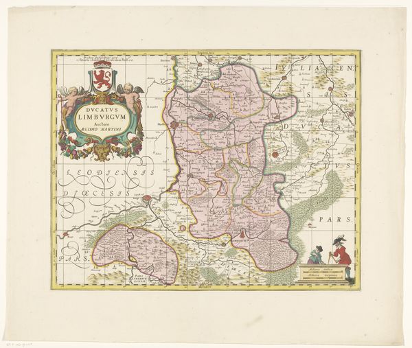
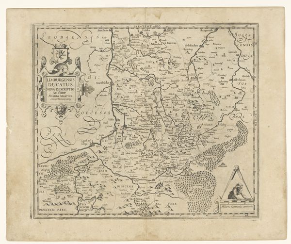
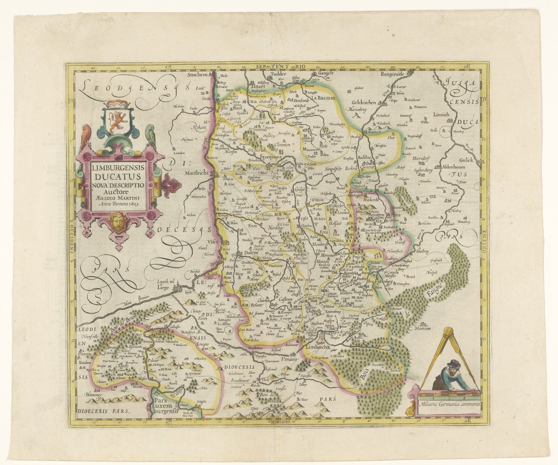
Curator: I’m immediately struck by the almost dreamlike quality of this map. It’s a blend of the factual and the fanciful, isn't it? Editor: Indeed. What we’re looking at is a Dutch Golden Age print called “Kaart van het hertogdom Limburg,” or “Map of the Duchy of Limburg,” dating from about 1628 to 1633. The artist remains anonymous. The etching and engraving techniques, with later additions of watercolor, really do create this layered, evocative impression. Curator: It definitely transcends mere topography. See how the forests almost pulse with a life of their own? And the little figure in the lower corner, meticulously drafting away – is that an allegory of precision or just a cartographer showing his work? Editor: Both, I suspect. Look closely and you'll notice symbols embedded in the heraldry— the crowned lion signifies sovereignty, while floral flourishes and human faces hint at local governance and cultural identity. The overall effect is to stake claim, define territory, perhaps even to inspire a sense of belonging in the viewer. Curator: Maps, then, become potent statements of identity and power! It's a real visual archive of history. Does the layout or some visual trick enhance that goal? Editor: Observe the subtle shift of perspectives; at points, the terrain seems almost tilted towards the viewer. Roads converge, forests invite—these could evoke specific journeys, personal encounters, making this abstracted duchy remarkably tangible. What does the artwork "tell" you, not about land, but culture? Curator: I hear an unspoken confidence and ingenuity of humankind! From the initial lines etched to capture landscape details to adding the very last watercolors for artistic finesse—it suggests a complete understanding of the area by someone very involved. I am just left wondering how many stories are hidden in these hand-drawn borders. Editor: And perhaps that's the lasting power of this print—to pique curiosity. What I see here is far more than a means of getting from one village to another, and rather a celebration of place and a people who call that territory home.
Artwork details
- Medium
- print, etching, engraving
- Dimensions
- height 397 mm, width 457 mm
- Copyright
- Rijks Museum: Open Domain
Tags
Comments
Share your thoughts
About this artwork
Curator: I’m immediately struck by the almost dreamlike quality of this map. It’s a blend of the factual and the fanciful, isn't it? Editor: Indeed. What we’re looking at is a Dutch Golden Age print called “Kaart van het hertogdom Limburg,” or “Map of the Duchy of Limburg,” dating from about 1628 to 1633. The artist remains anonymous. The etching and engraving techniques, with later additions of watercolor, really do create this layered, evocative impression. Curator: It definitely transcends mere topography. See how the forests almost pulse with a life of their own? And the little figure in the lower corner, meticulously drafting away – is that an allegory of precision or just a cartographer showing his work? Editor: Both, I suspect. Look closely and you'll notice symbols embedded in the heraldry— the crowned lion signifies sovereignty, while floral flourishes and human faces hint at local governance and cultural identity. The overall effect is to stake claim, define territory, perhaps even to inspire a sense of belonging in the viewer. Curator: Maps, then, become potent statements of identity and power! It's a real visual archive of history. Does the layout or some visual trick enhance that goal? Editor: Observe the subtle shift of perspectives; at points, the terrain seems almost tilted towards the viewer. Roads converge, forests invite—these could evoke specific journeys, personal encounters, making this abstracted duchy remarkably tangible. What does the artwork "tell" you, not about land, but culture? Curator: I hear an unspoken confidence and ingenuity of humankind! From the initial lines etched to capture landscape details to adding the very last watercolors for artistic finesse—it suggests a complete understanding of the area by someone very involved. I am just left wondering how many stories are hidden in these hand-drawn borders. Editor: And perhaps that's the lasting power of this print—to pique curiosity. What I see here is far more than a means of getting from one village to another, and rather a celebration of place and a people who call that territory home.
Comments
Share your thoughts