print, etching, engraving
#
map drawing
# print
#
etching
#
old engraving style
#
sketchwork
#
geometric
#
pen work
#
history-painting
#
engraving
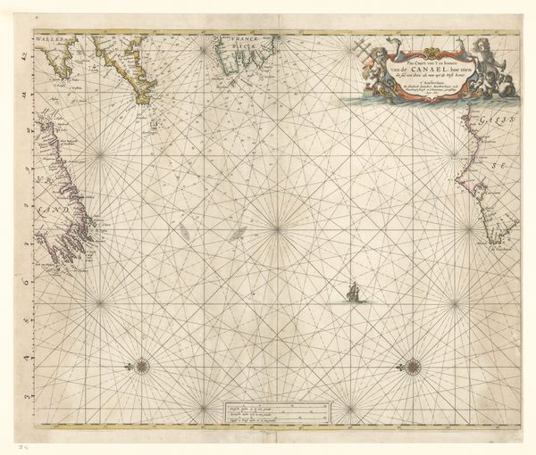
Dimensions: height 285 mm, width 354 mm
Copyright: Rijks Museum: Open Domain
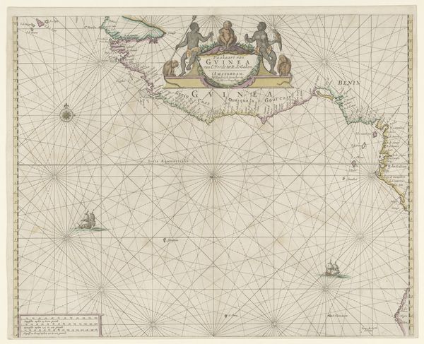
This is a map of the North Sea, charting the naval battle at Dogger Bank, made anonymously in 1781. Dominating the composition is the compass rose, an ancient symbol uniting direction and destiny. Rooted in antiquity, the compass rose guides not only the mariner but also the viewer through a sea of historical and cultural associations. Consider how the fleur-de-lis atop this compass mirrors its use in countless maps and coats of arms, transcending mere navigation to embody power, and even divine right. Think of the psychological comfort such a symbol provided, a beacon of order in the face of the ocean's chaotic potential. The symbolic weight of the compass rose echoes through time, its presence a testament to our primal need to map, understand, and control our world. This yearning connects us to those anonymous hands that crafted this map centuries ago.
Comments
No comments
Be the first to comment and join the conversation on the ultimate creative platform.
More like this