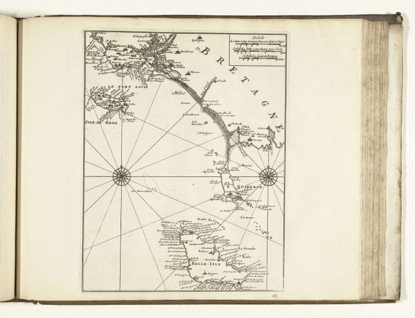
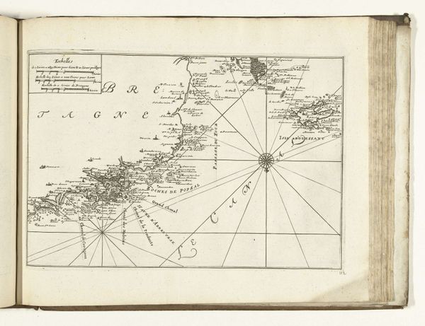
Kaart van de Franse westkust bij Île de Noirmoutier, ca. 1702 1702 - 1703
0:00
0:00
anonymous
Rijksmuseum
print, engraving
#
baroque
# print
#
landscape
#
geometric
#
history-painting
#
engraving
Dimensions: height 230 mm, width 335 mm
Copyright: Rijks Museum: Open Domain
Editor: This engraving, titled "Kaart van de Franse westkust bij \u00île de Noirmoutier", roughly translating to 'Map of the French west coast near the island of Noirmoutier', was made around 1702. What immediately strikes me is its precision; every line seems so carefully placed. How would you interpret a piece like this? Curator: For me, it's like peering into a mind obsessed with order. Not just geographically accurate, but conceptually ordered, you know? The landmasses rendered with what looks like almost painstaking detail, each tiny house etched on the Isle de Dieu—it’s the Baroque impulse toward cataloging the world. And consider that this was created during a time of intense naval competition. Doesn’t it feel… strategic? As if possessing the map were equivalent to possessing the territory? Does it provoke a feeling of, say, scientific discovery? Editor: I hadn’t really thought about that tension, but now it definitely colours how I see it! The geometry of those radiating lines almost seems like an assertion of control. Curator: Exactly! Each line a spoke in a web of… dare I say, ambition? Think about who would have commissioned this, who would have *used* it. Imagine their anxieties and hopes distilled onto this very page. It stops being "just a map" and becomes almost a portrait, of an era. Editor: So much more than just geography. Curator: Maps are stories, really, etched in ink. Or daydreams made solid. This one, in its rigorous, somewhat cold way, speaks volumes. What would a contemporary version tell, I wonder? Editor: Definitely given me a new appreciation for antique cartography! It really does feel like a blueprint for a whole historical narrative.
Comments
No comments
Be the first to comment and join the conversation on the ultimate creative platform.
More like this