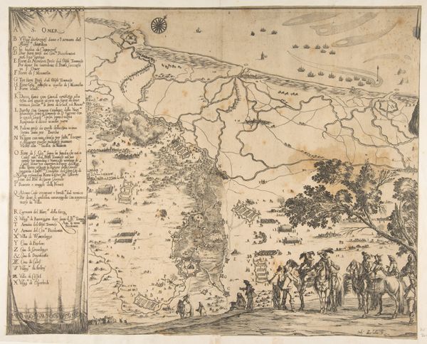
Gammel Elfborgs anfald ved Tordenskjold i 1719 1726 - 1757
0:00
0:00
print, etching, engraving
# print
#
etching
#
etching
#
engraving
Dimensions: 328 mm (height) x 377 mm (width) (plademaal)
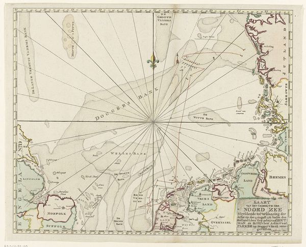
Editor: This is “Gammel Elfborgs anfald ved Tordenskjold i 1719,” an engraving and etching from between 1726 and 1757, currently residing at the SMK. It looks like a map depicting a naval battle, almost like a bird's eye view. What's striking is the cherubic figure in the corner seemingly overseeing the destruction. How do we interpret a battle through such a visually controlled image? Curator: Well, firstly, consider the context. These weren’t just maps, but political tools. The idealized depiction, almost a glorification of Tordenskjold's victory, speaks volumes. Notice the cartouche – the decorative element surrounding the title. It uses classical motifs to lend gravitas and legitimize the event and power. This battle would likely be framed in a context of political and cultural propaganda. How do you think the audience would have received this? Editor: It feels…sanitized. Distant. Not really focusing on the gritty reality of war, but reinforcing power structures and celebrating victory through symbolism. It seems more about making a statement. Curator: Exactly! These images played a crucial role in shaping public perception of military power and national identity. What purpose do you think it serves to portray something inherently chaotic and violent like naval battle into a neat and structured map? Editor: I think it would to inspire confidence and maybe intimidate rivals by showcasing military prowess as something that can be controlled and understood in such a measurable, cartographic form. I learned today about how art of this era had direct social impact, and that it wasn’t necessarily just "art for art's sake”. Curator: Precisely. Thinking about the intention changes everything, doesn't it? The act of seeing power solidified visually.
Comments
No comments
Be the first to comment and join the conversation on the ultimate creative platform.
More like this