print, etching, engraving
#
aged paper
#
natural shape and form
#
baroque
# print
#
etching
#
landscape
#
etching
#
natural palette
#
engraving
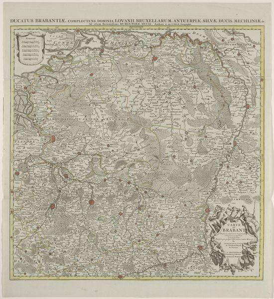
Dimensions: height 645 mm, width 646 mm
Copyright: Rijks Museum: Open Domain
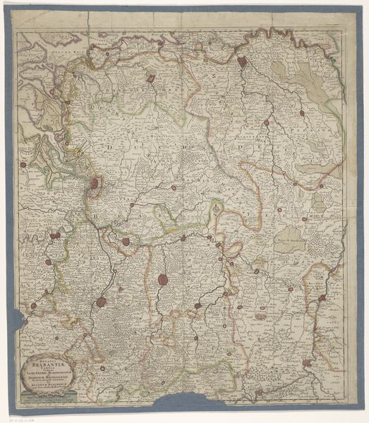
Henri Liebaux's "Kaart van Brabant" presents us with a cartographic snapshot of Brabant. It's important to remember that map-making in the 18th century was more than just geographic documentation; it was also a political act. Liebaux created this map in a period rife with shifting territorial claims. The area was a strategic battleground, and maps like these were instrumental in asserting control and understanding resources. This map is filled with the socio-political context of its time, reflecting the competing claims and power struggles that defined the region. Take notice of the intricate details, the boundaries, and the way cities and landscapes are depicted. It’s a reflection of how the ruling powers wanted the territory to be perceived. As you consider the "Kaart van Brabant," think about the stories it silently tells about power, land, and the people who lived there. It's a reminder that even something as seemingly objective as a map can be deeply embedded with identity.
Comments
No comments
Be the first to comment and join the conversation on the ultimate creative platform.
More like this