drawing, painting, paper, watercolor
#
drawing
#
water colours
#
painting
#
landscape
#
paper
#
watercolor
#
watercolour illustration
Dimensions: height 204 mm, width 291 mm
Copyright: Rijks Museum: Open Domain
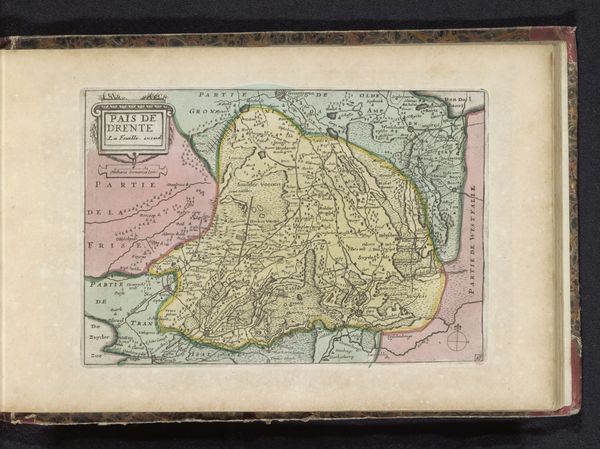
This map of Drenthe was made by Studio Certo in 1940 and it’s like a painting disguised as a practical tool. I’m drawn to the earthy, muted palette; it’s so different from the garish digital maps we’re used to now. Look closely, and you’ll see the artist has hand-drawn every road and river, each tiny village rendered with care. The texture is smooth, but you can almost feel the hand of the maker in every line, and the delicate washes of color, which add a real sense of depth. Notice the way the artist has depicted the forests and fields, not with scientific accuracy, but with a kind of poetic license. This map feels like a relative of Paul Klee’s whimsical cityscapes, where reality and imagination blend seamlessly. It's a reminder that art, like maps, isn't just about showing us where to go, but about inviting us to see the world in new ways.
Comments
No comments
Be the first to comment and join the conversation on the ultimate creative platform.
More like this