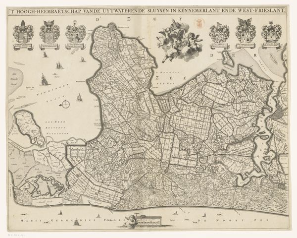
1762 - 1773
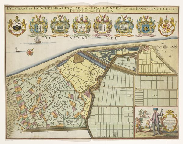
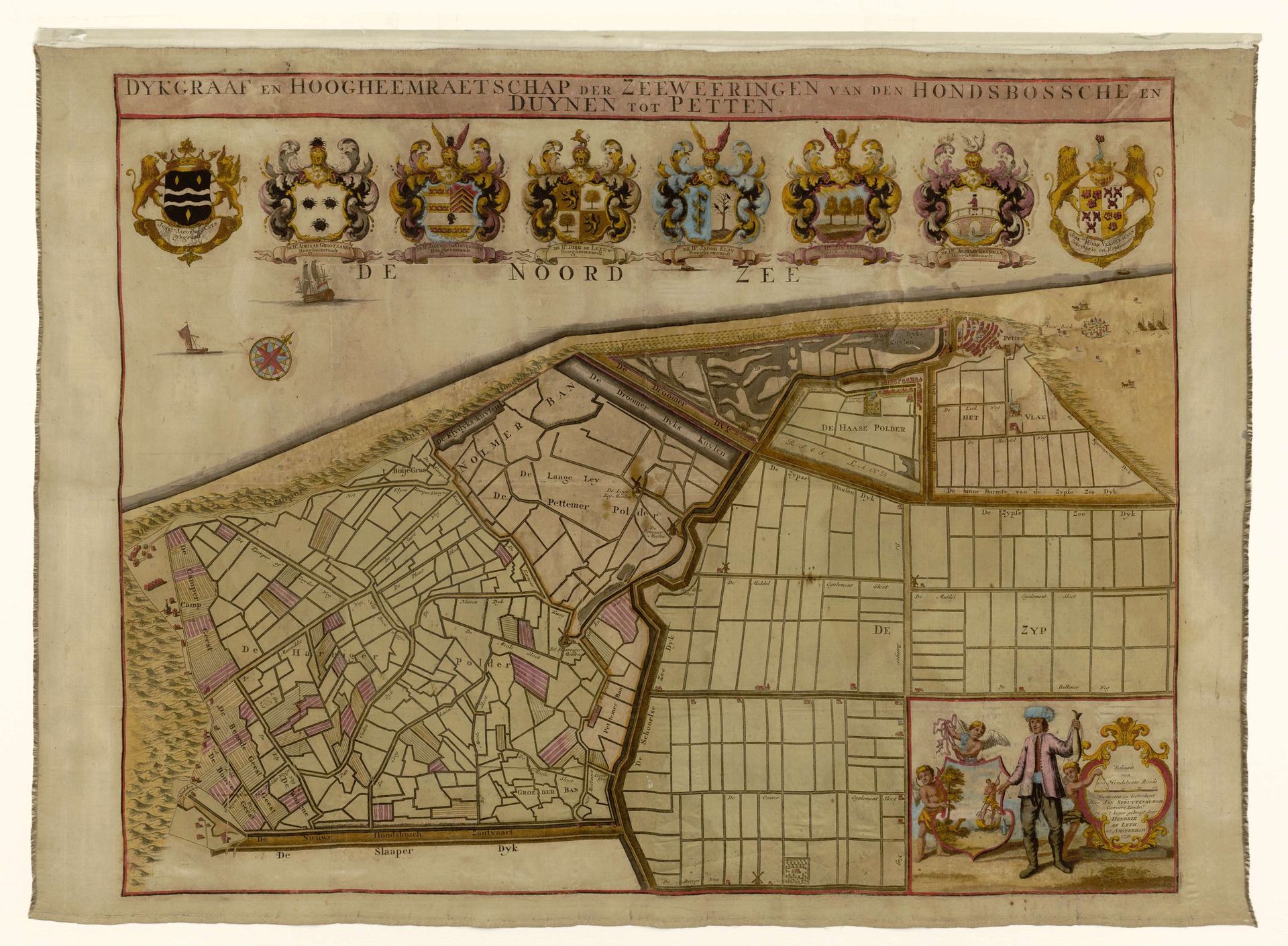
Kaart van de Hondsbossche Zeewering en de duinen bij Petten
Hendrik de Leth
1703 - 1766Location
RijksmuseumListen to curator's interpretation
Curatorial notes
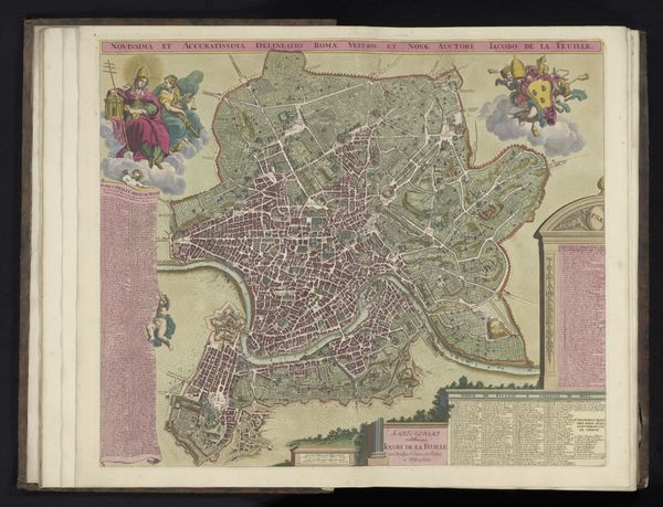
Curator: I'm struck by the almost geometrical orderliness in Hendrik de Leth’s "Kaart van de Hondsbossche Zeewering en de duinen bij Petten." Made sometime between 1762 and 1773, this engraving depicts a map of the Hondsbossche sea defenses and the dunes near Petten, a region in the Netherlands. Editor: It gives me an immediate sense of a meticulously planned and intensely controlled landscape. Everything looks divided, partitioned. But even the crisp engraving technique, its clear lines, speaks to that feeling of mastery, an effort to dominate the chaos of nature with human ingenuity. Curator: Indeed, cartography itself served as a powerful symbol during the Dutch Golden Age. Mapping, of course, gave practical power. This map isn’t merely decorative, it reflects both social organization and civic duty. It's worth noting the shields arrayed at the top. They lend the work an almost heraldic significance. Editor: Ah, yes! And think of the labour involved. The surveying, the engraving process itself... the specialized knowledge required to even produce the paper on which it is printed. This piece is a material record of both a planned infrastructure and of a network of skilled laborers producing something that transcends simple geography. It's about value in land and value in labour. Curator: Very true! And there's an implicit narrative—the Dutch have, throughout history, fought the sea. This is no ordinary landscape, these coastal fortifications protect lives, homes and businesses. Therefore, this engraving speaks volumes about a deep-seated cultural imperative: control over one’s environment is the essence of a free society. Editor: That brings an additional emotional weight. The image is far from just topography; it represents a sustained collective struggle against the elements, a struggle dependent on communal effort and skillful materiality. The image reminds me of that tension that emerges from forcing nature to accommodate us. It gives me pause, thinking about the consequences. Curator: This engraving has certainly provided insights, a layered understanding of history, craftsmanship and psychological drive, even across centuries. Editor: Agreed. It really encourages a reassessment of landscape representation by including labour practices to generate an entirely new cultural perception.