graphic-art, print, engraving
#
graphic-art
#
pen drawing
#
dutch-golden-age
# print
#
old engraving style
#
landscape
#
engraving
Dimensions: height 540 mm, width 679 mm
Copyright: Rijks Museum: Open Domain
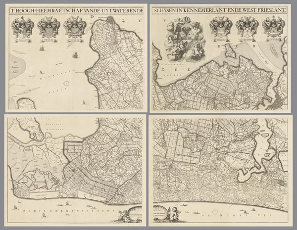
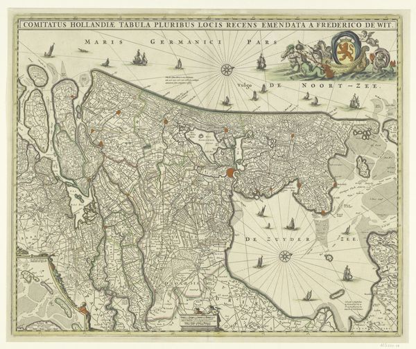
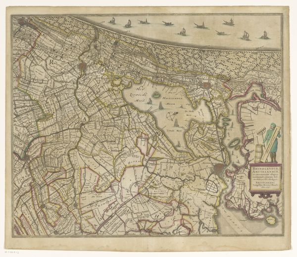
Editor: Here we have "Kaart van Kennemerland en West-Friesland," a map by Coenraet Decker, created between 1682 and 1686. It’s an engraving, part of the Rijksmuseum collection. What immediately strikes me is the sheer level of detail; it’s like a bird's-eye view, but also dense with information. How do you interpret the symbols and imagery chosen for this map? Curator: Ah, a cartographic cornucopia of symbolic weight! Maps are never neutral. Notice how the cherubs near the top float above the land. What feelings do they evoke? Editor: Hmm, perhaps a sense of divine blessing or overseeing the territory? Curator: Precisely. Consider the coats of arms lining the top—symbols of power and authority that underscore the families who governed and benefited from this land. Then there's the presence of sea monsters! How might their presence on a map like this affect its perceived trustworthiness, and what might they symbolize? Editor: They definitely add a sense of the unknown, or a reminder of nature’s power. Maybe also as something dangerous but now charted, almost conquered. Curator: Interesting thought! The very act of mapping implies control, doesn't it? Note the details of ships and landmarks: each serves as a miniature signpost, loaded with the cultural memory and social value of its era. Editor: So, it’s more than just directions; it's about visually claiming the space and alluding to societal power dynamics? Curator: Exactly. Visual language communicates those messages as clearly as any written document. It causes us to reflect on humanity's relationship with the world around us. What I find most profound here is the juxtaposition of established dominion against potential untamed chaos and the sublime. It’s there in the art; what we see, and how we react to that vision. Editor: I hadn't considered how forceful the claim could be. I see the map as a historical document, not necessarily a form of propaganda. That changed my mind about cartography. Thank you. Curator: And thank you. Each map tells its tale, it just requires attentive viewing.
Comments
No comments
Be the first to comment and join the conversation on the ultimate creative platform.
More like this