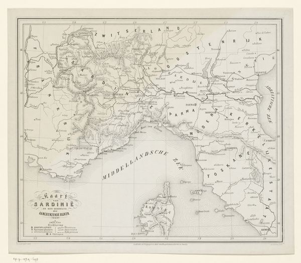
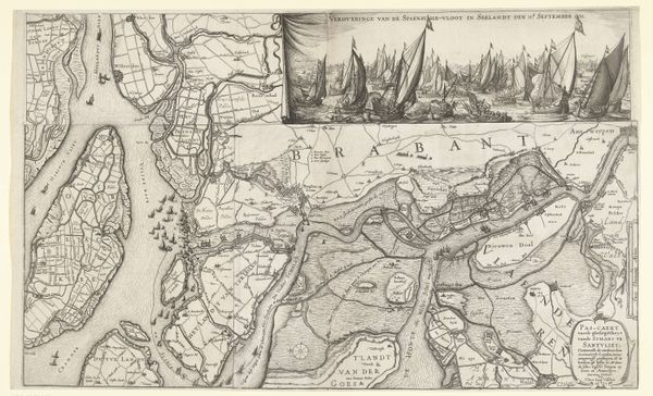
print, paper, ink, engraving
#
dutch-golden-age
# print
#
landscape
#
paper
#
ink
#
cityscape
#
engraving
Dimensions: height 338 mm, width 490 mm
Copyright: Rijks Museum: Open Domain
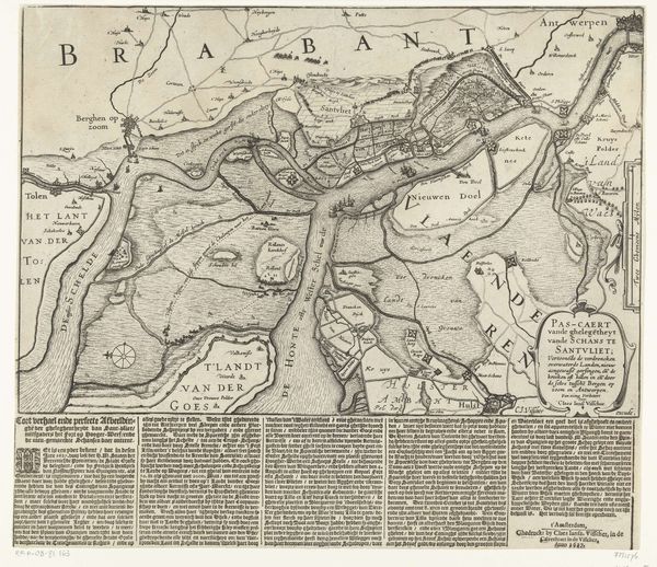
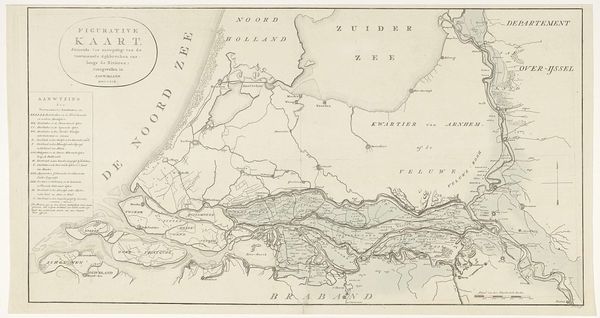
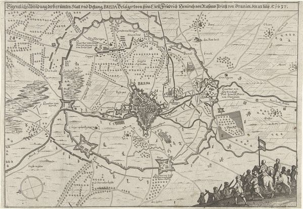
Curator: Here we have an intriguing engraving from between 1629 and 1665 titled, "Forten aan de Ooster- en Westerschelde, 1627." It's an anonymous work currently residing here at the Rijksmuseum. Editor: It looks like a sprawling puzzle of land and water! My eye darts all over the place, trying to piece it together. There's almost a chaotic beauty to it. A tangled mess of lines, labeling forgotten forts and rivers, that once pulsed with ambition. Curator: Indeed. This work serves as a strategic and historical record, highlighting the complex network of fortifications along the Eastern and Western Scheldt rivers during a turbulent period of Dutch history. You can really sense how conflict shaped the landscape itself. Editor: Right, a weapon forged in ink! But looking at it, it feels less about straight battle strategy and more a ghostly image of borders that have come and gone. Terra Inundata... flooded lands. I wonder about the human cost of that watery strategy. It looks almost beautiful now, though, these delicate lines, but probably deadly serious for the people living there. Curator: Absolutely. The image reminds us of the constant struggle for territory and resources in the early modern period, revealing the immense engineering efforts and, as you noted, the social disruption it created. Mapping was power; deciding where the water would flow decided fortunes. Editor: Do you think the anonymity is deliberate, almost institutional? As if this level of geographical strategy should always be above individual ambition, maybe? That makes me think about who ordered the drawing of it as much as who drew it! Curator: That's astute. Anonymity removes personal biases. We should consider these pieces less as autonomous artworks and more as tools created for governance and military planning. Its purpose overshadows the identity of its creator, reinforcing its role as an objective representation of space and power. Editor: Still, someone chose these lines, this layout... I'd love to see how another artist would've seen it, you know? All the life and politics squashed into neat topography! The life behind the neat, organized borders and cities. It feels almost cheeky and secretive. Like it might reveal a forgotten narrative with enough staring. Curator: Perhaps its open availability within a museum like this democratizes that earlier intention, inviting these diverse interpretations, ensuring ongoing dialogues far removed from those initial objectives. Editor: True. Funny how something intended to direct warfare eventually lets us get lost in the space and ask so many what ifs? Thanks for pointing the cannons out!
Comments
No comments
Be the first to comment and join the conversation on the ultimate creative platform.
More like this