graphic-art, print, engraving
#
graphic-art
#
dutch-golden-age
# print
#
landscape
#
geometric
#
line
#
engraving
Dimensions: height 277 mm, width 519 mm
Copyright: Rijks Museum: Open Domain
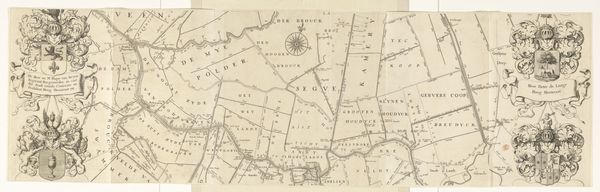
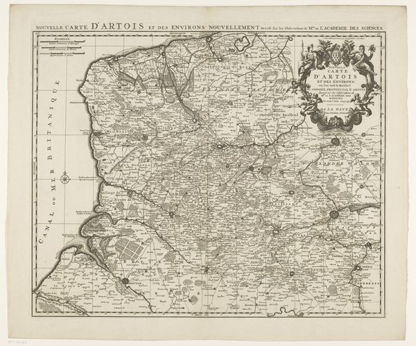
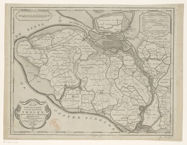
Curator: Ah, another fascinating print from the Dutch Golden Age. This is Jacob van Meurs's "Kaart van het kwartier Westergo," created in 1664. Editor: My first thought is: this is like staring into a spiderweb made of villages. The lines seem to cling, each marking property or boundary, a beautiful manifestation of control. Curator: Control is certainly a theme. We see it echoed throughout the Dutch Republic during this era of massive overseas trade and colonialism. Maps weren't just representations, they were instruments of power. This engraving uses line work so sharp it is easy to imagine administrators, traders and generals gathering to pore over these details as they lay claim to both land and waterways. Editor: It's funny to think that behind these formal cartographies, are real stories of communities shaped and reshaped by this relentless expansion of infrastructure and borders. I notice the delicate lines defining property or districts—invisible to the naked eye from the ground, yet so powerful in dictating lives. The rivers squiggle along in comparison almost mocking the rigidly planned boundaries. Curator: Yes, it is an interesting comparison, isn’t it? A sense of pre-industrial ordering, that speaks volumes about a desire for imposing a logic of ownership. Land and waterways alike are tools for nation-building. The details provide glimpses into economic and political realities; do you notice the symbols? I spot churches, windmills, perhaps farmhouses or even grand estates meticulously plotted in each designated lot. Editor: This isn't just geographical data, it's a societal snapshot rendered through graphic art. It’s almost utopian to consider it so. And in thinking that, perhaps this offers viewers the freedom to reflect upon these mapped spaces in the present tense. Has much really changed in that power relationship that the Dutch hold over that soil today? Is there still a similar pursuit of control? These might not be pleasant or comforting avenues of consideration, but there's beauty in realizing such thought, and acknowledging art can do more than please. Curator: Precisely. It's that tension between the desire to chart and order, and the often-unfolding chaotic realities of a landscape constantly shaped by forces beyond human command that gives this print such staying power. Thank you, it is that perspective I truly enjoy the most: that these antique pieces still allow for some creative imagination. Editor: A perfect blend of historical analysis and artistic empathy!
Comments
No comments
Be the first to comment and join the conversation on the ultimate creative platform.
More like this