print, engraving
# print
#
etching
#
geometric
#
geometric-abstraction
#
line
#
history-painting
#
engraving
Dimensions: height 509 mm, width 608 mm
Copyright: Rijks Museum: Open Domain
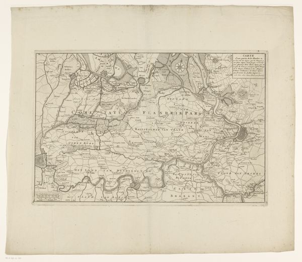
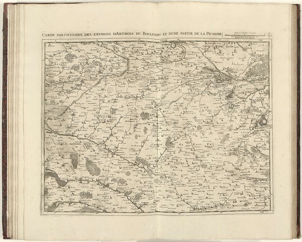
Luggert van Anse made this map of the County of Artois using engraving, a printmaking process that involves cutting lines into a metal plate. The plate is then inked, and the ink is transferred to paper under high pressure. The material of the map—paper, ink, and metal—reflects the precision and detail of the engraving. Each line, symbol, and name is carefully rendered, providing a wealth of geographical and cultural information. The map shows how skilled craftsmanship and cartography merged in early modern Europe. Engraving demands immense labor and skill. The engraver must possess a deep understanding of the materials and tools, as well as considerable artistic talent. This map shows the convergence of scientific exploration, artistic skill, and economic enterprise. This challenges traditional distinctions between art, science, and commerce.
Comments
No comments
Be the first to comment and join the conversation on the ultimate creative platform.
More like this