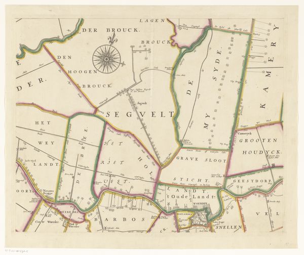
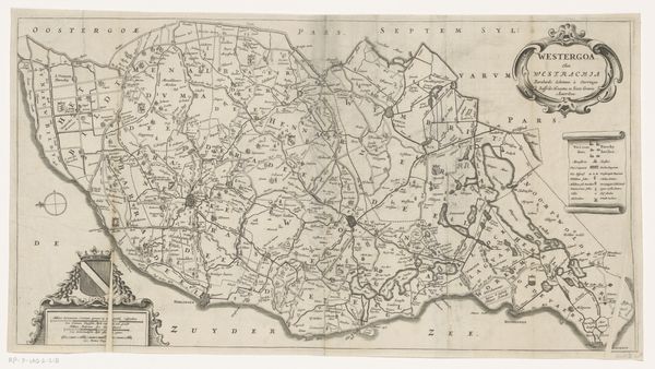
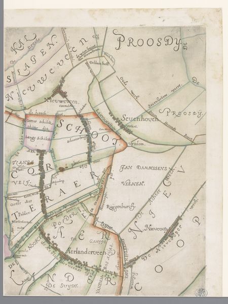
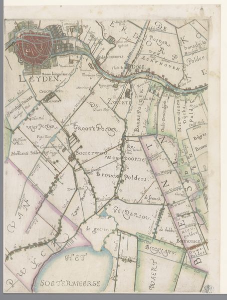
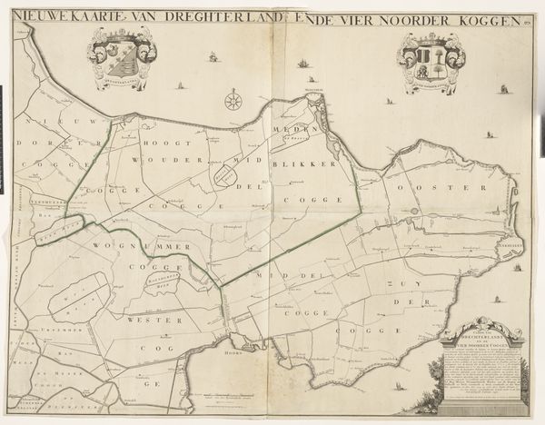
Kaart van het Hoogheemraadschap van Woerden (middelste deel) 1670 - 1690
0:00
0:00
justusvinckboons
Rijksmuseum
drawing, paper, ink
#
drawing
#
dutch-golden-age
#
pen sketch
#
landscape
#
paper
#
ink
#
geometric
Dimensions: height 417 mm, width 1534 mm
Copyright: Rijks Museum: Open Domain
Editor: So, this is "Kaart van het Hoogheemraadschap van Woerden (middelste deel)," a map from somewhere between 1670 and 1690 by Justus Vinckboons, created with ink on paper. It's quite intricate. The geometric shapes marking the land are very interesting but I don't quite grasp how I am meant to understand this piece of paper as art. What do you see in this map beyond its obvious practical purpose? Curator: It’s tempting to dismiss this as purely functional, but let's consider the labour embedded within its production. The creation of maps at this time involved extensive surveying, draftsmanship, and specialised knowledge. How was this knowledge obtained, disseminated and controlled by certain communities or guilds? Editor: I hadn’t considered the physical act of surveying the land as an element of the creative process! So, would you say that this changes the understanding of the "pen sketch" as a medium itself, going beyond simple artistic expression? Curator: Precisely. Maps like these were not just about depicting space; they were about claiming ownership, controlling resources, and visually codifying power relations. Notice the coats of arms, symbols of local powers – whose land, labor and tools were they controlling, and for what end? We might ask: how did the rise of cartography influence land ownership and social structures in the Dutch Golden Age? Editor: Thinking about it that way really highlights how something we see as an objective representation of the world is deeply entwined with economic and social realities. Curator: Indeed. Consider the production and use of ink and paper too. These materials were valuable commodities, reflecting broader trade networks. Looking beyond the aesthetic to the underlying systems reveals a rich historical and social tapestry. Editor: I see what you mean, there is certainly more here than meets the eye at first glance. I will need to shift my focus to really appreciate pieces like this. Curator: Every object has a story embedded in its creation, materials, and context. Thinking about "who made it, how was it made and who benefitted from it?" can often unlock it.
Comments
No comments
Be the first to comment and join the conversation on the ultimate creative platform.
More like this