graphic-art, print
#
art-deco
#
graphic-art
# print
#
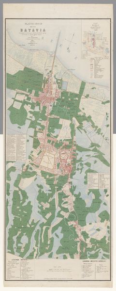
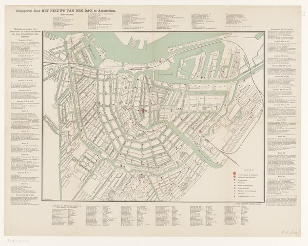
cityscape
Dimensions: height 557 mm, width 447 mm
Copyright: Rijks Museum: Open Domain
This is a 1934 map of Madrid, made by an anonymous cartographer and published by D. Vicente de Castro Les. What's fascinating is how this ostensibly neutral tool reflects the social and political climate of its time. Produced during the Second Republic, a period of rapid modernization and social change, the map visualizes Madrid as a city on the cusp of transformation, carefully gridded and color-coded. Look closely, and you'll see more than just streets and buildings. The map highlights new developments, reflecting the Republic's ambitions for urban planning and modernization. But beneath the surface, tensions simmered. The stark organization hints at attempts to impose order on a society grappling with deep divisions. Understanding this map requires historical context. Researching urban planning initiatives of the Second Republic, studying period newspapers, and exploring archival documents can reveal the map's role in shaping perceptions of Madrid and its future. The social and institutional context is key to deciphering the meaning of this artifact.
Comments
No comments
Be the first to comment and join the conversation on the ultimate creative platform.
More like this