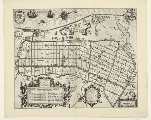
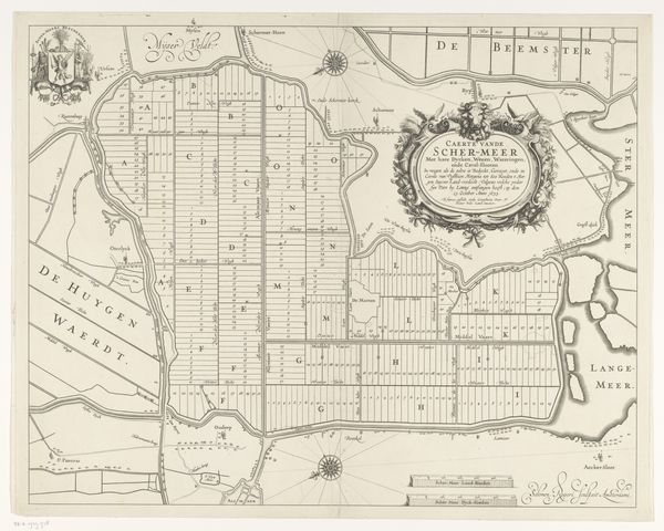
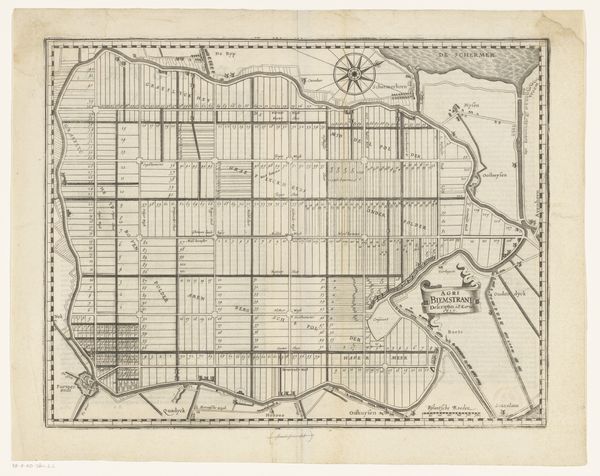
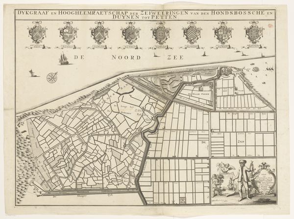
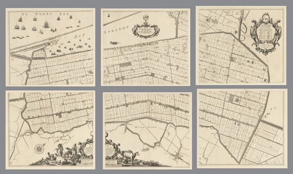
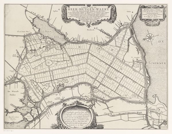
Blad met kaarten van de polders van de Zijpe, Beemster, Purmer, Wormer en een kaart van Waterland. 1631 - 1633
0:00
0:00
pietervanderkeere
Rijksmuseum
drawing, print, paper, engraving
#
drawing
#
comic strip sketch
#
dutch-golden-age
# print
#
pen illustration
#
pen sketch
#
landscape
#
paper
#
personal sketchbook
#
pen-ink sketch
#
thin linework
#
line
#
pen work
#
sketchbook drawing
#
storyboard and sketchbook work
#
sketchbook art
#
engraving
Dimensions: height 349 mm, width 471 mm
Copyright: Rijks Museum: Open Domain
Curator: We're looking at "Blad met kaarten van de polders van de Zijpe, Beemster, Purmer, Wormer en een kaart van Waterland" created between 1631 and 1633. It's held here at the Rijksmuseum, and the artist was Pieter van der Keere. Editor: Immediately, it feels incredibly ordered. Like someone desperately wanted to make sense of a landscape, almost forcing it into neat little boxes. But those delicate lines also breathe a kind of peace. It reminds me of the precision you see in architectural plans but applied to nature. Curator: Precisely! What you're seeing is a map showcasing newly reclaimed polders. This wasn’t just about charting territory; it was a display of Dutch engineering prowess and a statement of control over the water, transforming marshland into usable farmland and living space. This print reflects the optimism and almost aggressive industriousness of the Golden Age. Editor: Aggressive! I see that. I mean, looking closer, there's a palpable sense of human intervention; like we are saying: "Okay, water, you used to be here but *we* decided otherwise." You can feel the collective will etched into those grids, shaping the very earth. There's a deep political and economic narrative there, all rendered so elegantly. But I still see that strange harmony, maybe from how all the canals work as mirrors. Curator: Absolutely. Land reclamation had massive economic and social implications. These polders became incredibly valuable real estate, reshaping power dynamics and contributing to the wealth that fueled the Golden Age. It really was nation-building through cartography, if you will, showing how geographical control translated to actual power on the ground, and the expansion of a nation. Editor: I love how something as functional as a map, something created for utterly practical purposes, becomes a beautiful object and, really, an artwork in itself. And more than that, how it makes us think about our relationship with nature and what "improvement" actually means in the long run. Curator: It really pushes us to ask these hard questions. Next time you see a perfectly square field in the Netherlands, maybe you’ll think about the incredible ambition and engineering behind it—and its echoes in this print. Editor: I never thought a map could be so evocative. Next time I see the Netherlands, I'm going to read between those water lines... literally.
Comments
No comments
Be the first to comment and join the conversation on the ultimate creative platform.
More like this