# print
#
geometric
#
cityscape
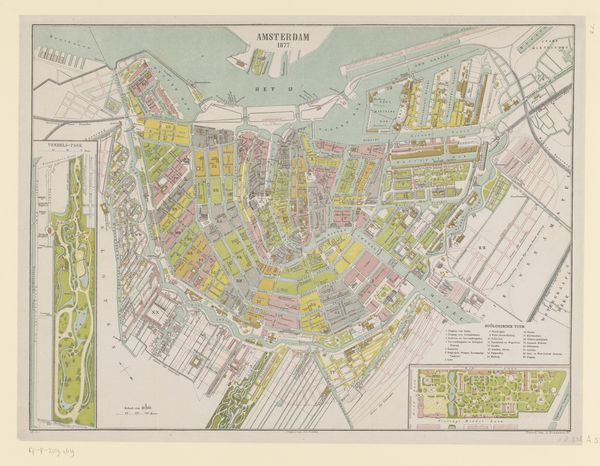
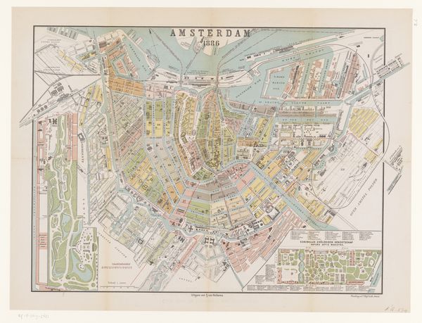
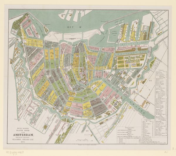
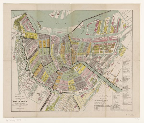
Dimensions: height 415 mm, width 558 mm
Copyright: Rijks Museum: Open Domain
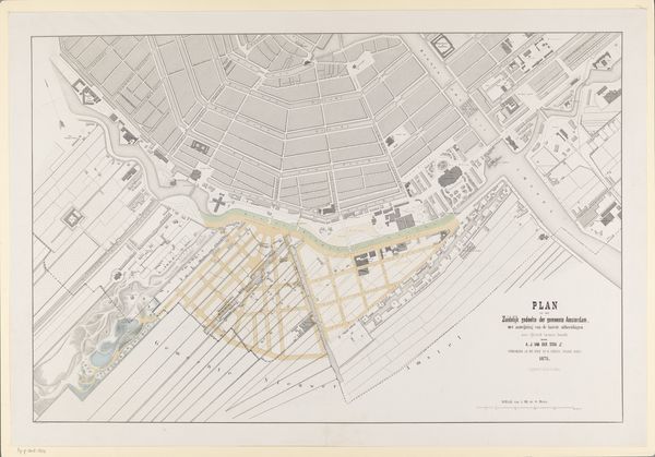
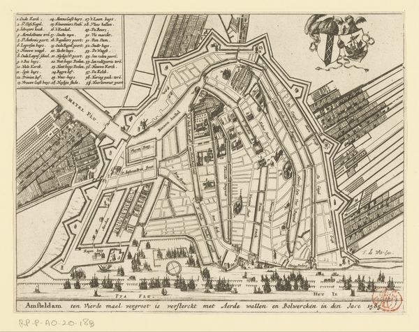
Editor: Here we have Albertus Braakensiek's "Plattegrond van Amsterdam, 1882", a printed map. It’s amazing how detailed it is. What strikes me is the geometric arrangement of the city and the color-coded districts. What story do you think it tells? Curator: This map transcends its function as mere cartography. It is a potent cultural artifact that reveals the sociopolitical landscape of Amsterdam in 1882. Consider the rapid industrialization occurring at that time and how it physically reshaped the city, often marginalizing certain populations. Editor: So, you're suggesting we can read it beyond just street names? Curator: Absolutely. Look at the way the different areas are segmented and coloured. Are these distinctions purely functional or do they reflect economic or social disparities? Maps are never neutral; they always represent a particular viewpoint, a specific power structure asserting its vision of the world. What do you notice about the water distribution? Editor: The canals seem very prominent. I guess it makes sense, being Amsterdam. Curator: Exactly. Consider how these waterways facilitated trade and shaped labour practices, but also how they might have been implicated in sanitation and public health issues affecting the working class. Furthermore, what do we know of Braakensiek? Editor: I confess, not much at this moment. Curator: Well, understanding his positionality – his own class, gender, and political affiliations – can further illuminate how those biases may have influenced his choices in constructing this representation of Amsterdam. Perhaps, it's also pertinent to analyse for the people who the map was designed for, what story did the 'map-maker' want to project? Editor: This map is not just a guide but a narrative! I hadn’t considered the social commentary a city plan could provide. Thanks! Curator: Precisely. Thinking critically about the context of an artwork such as this map makes you engage in active, meaningful dialogue, and further interrogation will shed greater light on this subject.
Comments
No comments
Be the first to comment and join the conversation on the ultimate creative platform.
More like this