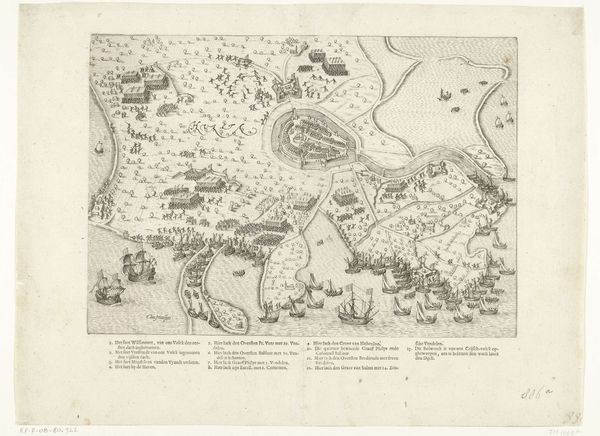
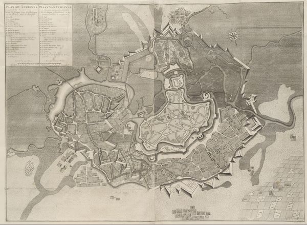
Plattegrond van de versterkingen van Rijsel en de citadel, 1708 1709
jacobusharrewijn
Rijksmuseum
print, engraving
baroque
old engraving style
cityscape
engraving
Dimensions: height 450 mm, width 564 mm
Copyright: Rijks Museum: Open Domain
Editor: Here we have Jacobus Harrewijn’s 1709 engraving, "Plattegrond van de versterkingen van Rijsel en de citadel, 1708", depicting a city plan of Lille. The precision is remarkable, it really highlights a calculated control over urban space. What strikes you when you examine the materiality and context of this work? Curator: It's precisely that tension – the hand-crafted nature of an engraving employed to delineate and control space – that I find so compelling. Think about the laborious process: the engraver meticulously carving lines into a metal plate. The printing process inherently involved many human steps, with unique products from each. Editor: I hadn’t thought about that. So the "control" being illustrated required intense labour and production? Curator: Exactly. And this isn't just about representing the city. It's about power structures, military strategy, and control over resources and people. What materials were invested into building Lille? The engraving functions as a blueprint for domination, reflecting a societal obsession with order and strategic advantage. This reveals a tangible manipulation and reordering of natural resources. Where do the resources to create and sustain that labour originate? Editor: I see. The image isn’t just about urban planning; it's an artifact documenting labour, resources and Baroque society’s ambition to order the world around them. The "Old Engraving Style" tag, makes me aware of how outdated our sense of resources have evolved. Curator: Precisely. The engraving itself becomes evidence of Baroque-era aspirations and industrial ambition through both medium and subject. Editor: Looking at the work this way is revealing how linked it is with industry and cultural intention of material control.
Comments
No comments
Be the first to comment and join the conversation on the ultimate creative platform.