drawing, print, ink, engraving
drawing
pen sketch
ink
cityscape
engraving
Dimensions: height 403 mm, width 488 mm
Copyright: Rijks Museum: Open Domain
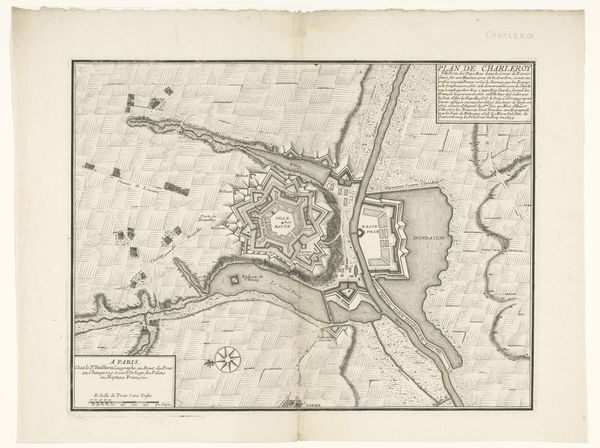
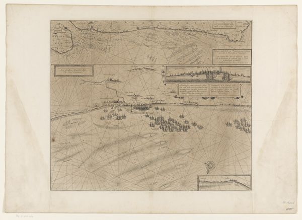
Gerrit Drogenham created this map of Douay in 1710 using etching and engraving. Notice how the composition organizes space through a stark contrast between the structured geometry of the fortified city and the organic sprawl of the surrounding landscape. The dark, precise lines used to depict buildings and fortifications sharply contrast the lighter, more fluid lines of the fields and waterways. This contrast isn't just aesthetic; it reflects a period where urban planning was deeply intertwined with military strategy. The formal layout of the city, with its star-shaped fortifications, speaks to the era’s obsession with control and order. Consider the map as a semiotic system. Each line and symbol acts as a sign, communicating not just geographical data but also power dynamics. The geometric precision of the city challenges our expectations of natural form, imposing a human-made order on the landscape. This tension between the organic and the geometric is a key aspect of how the artwork communicates a sense of power.
Comments
No comments
Be the first to comment and join the conversation on the ultimate creative platform.
More like this