drawing, print, ink, engraving
#
drawing
#
baroque
# print
#
ink
#
geometric
#
cityscape
#
engraving
Dimensions: height 520 mm, width 590 mm
Copyright: Rijks Museum: Open Domain
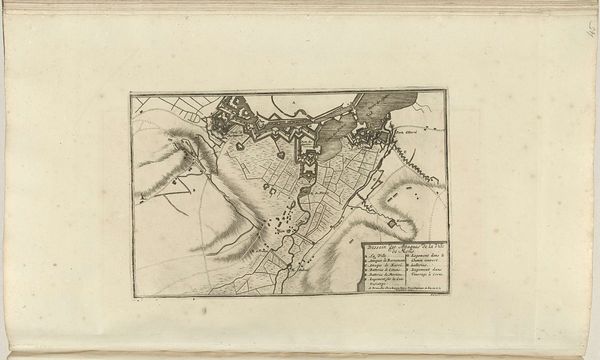
Pieter van Call the Younger made this map of the siege of Mons in 1709, using ink on paper. The etching process involved coating a metal plate with a waxy, acid-resistant substance, drawing through this to expose the metal, and then bathing the plate in acid. Look closely, and you'll see the fine lines created by this process lend an incredible amount of detail to the map; it is precise and technical. The lines depict not only the architecture of the besieged city, but also the surrounding topography. In addition, the labor-intensive etching process used to create this map, combined with the skill of the artist, give the work a sense of value beyond its function as a record of the siege. This intersection of artistry and technique is what makes this map a compelling piece of historical documentation and a work of art. Appreciating the labor and skill involved blurs the boundary between craft and fine art.
Comments
No comments
Be the first to comment and join the conversation on the ultimate creative platform.
More like this