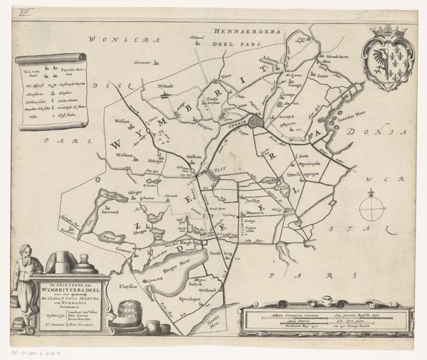
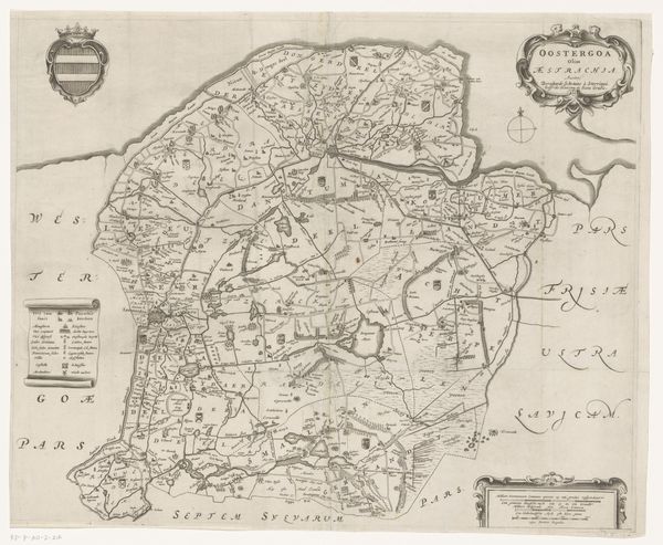
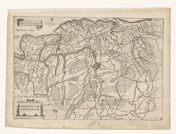
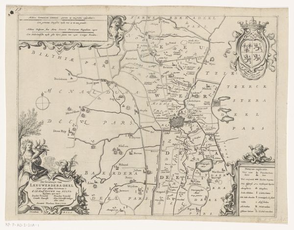
Kaart van het Hoogheemraadschap van Delfland, met 's-Gravenzande, Schipluiden en Schiedam, onderste deel 1611 - 1692
0:00
0:00
florisbalthasarszvanberckenrode
Rijksmuseum
print, etching
#
dutch-golden-age
# print
#
etching
#
landscape
#
geometric
Dimensions: height 442 mm, width 906 mm
Copyright: Rijks Museum: Open Domain
Floris Balthasarsz van Berckenrode made this map of the Delfland region using pen and ink. In the 17th century, maps were more than just geographical tools; they were powerful symbols of social order and control. This map meticulously charts the waterways and polders, reflecting the Dutch Republic’s intense engagement with land reclamation and water management. The detailed rendering of Delfland underscores the region's economic importance and the sophisticated engineering required to maintain it. Consider the High Water Authority, or "Hoogheemraadschap," an institution that played a vital role in governing these hydraulic works. Maps like this one visually reinforced their authority and the immense labor invested in shaping the Dutch landscape. To truly understand this map, delve into archives, engineering reports, and local histories. By exploring such resources, we discover how art is embedded in the structures of power and shapes the social reality of its time.
Comments
No comments
Be the first to comment and join the conversation on the ultimate creative platform.
More like this