print, engraving
# print
#
orientalism
#
engraving
Dimensions: height 184 mm, width 396 mm
Copyright: Rijks Museum: Open Domain
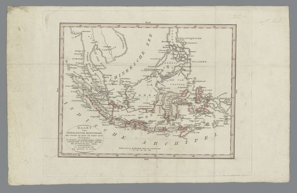
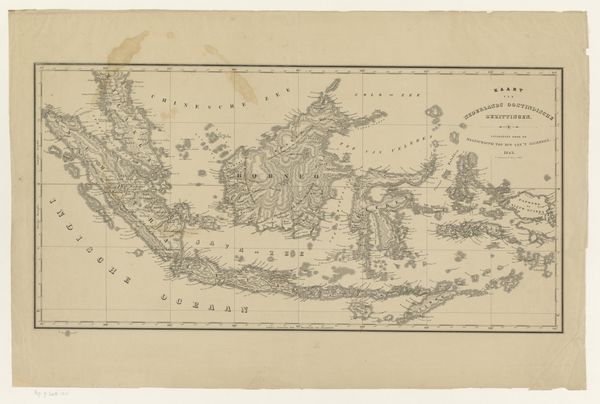
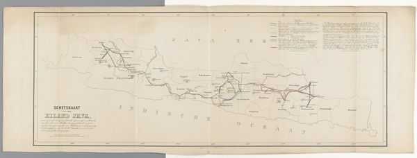
Curator: This print, crafted in 1863 by an anonymous artist, is titled "Kaart van Indonesië met daarop de stoombootdiensten aangegeven"—or, "Map of Indonesia indicating the steamboat services." It’s an engraving offering a very specific perspective. Editor: My first impression is one of constraint, strangely. It's visually appealing in its detail, but that spiderweb of steamboat routes laid over the archipelago feels like an imposed order. It whispers of colonial ambitions, wouldn't you say? Curator: Precisely. Maps are never neutral objects. Notice how the network of routes becomes a potent symbol of power, connecting disparate islands through a very controlled system. It reflects a worldview imposed from above. The red lines almost look like veins. Editor: Yes! This notion of control really hits hard when you consider the broader context. In the 19th century, Dutch colonial power in Indonesia relied heavily on resource extraction and forced labor. These steamboat routes, while ostensibly for trade and communication, facilitated the exploitation of land and people. Curator: You see a perfect melding of form and function in service of a very deliberate objective. Each place-name meticulously inscribed has emotional weight. These aren't neutral labels; each signifies a specific site of activity for Dutch colonialism. What do you see symbolically at play here? Editor: The rendering of the islands feels oddly sterile. There’s a clinical precision to the depiction, almost devoid of life outside of the designated routes and ports. I suppose the map flattens the local nuances, reinforcing the colonial narrative of "terra nullius," this land that is supposedly open for taking because they didn’t deem what existed before "enough." Curator: Agreed. And what remains absent becomes just as crucial. It shows only select names and routes deemed relevant by colonial authorities, diminishing the Indigenous knowledge of space, and ignoring other routes of exchange already in place for millennia. Editor: It certainly prompts me to reconsider how we interpret something as seemingly innocuous as a transportation route. I leave here realizing this artwork has so much to tell us about the past, how this piece acted as a kind of propaganda about technological advances and control. Curator: Indeed. Its graphic precision invites us to unravel the symbols of power embedded within it and consider all what maps leave out, whether deliberate or accidental.
Comments
No comments
Be the first to comment and join the conversation on the ultimate creative platform.
More like this