drawing, print, paper, ink
#
drawing
# print
#
asian-art
#
landscape
#
paper
#
ink
#
geometric
#
watercolour illustration
#
watercolor
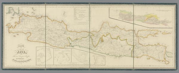
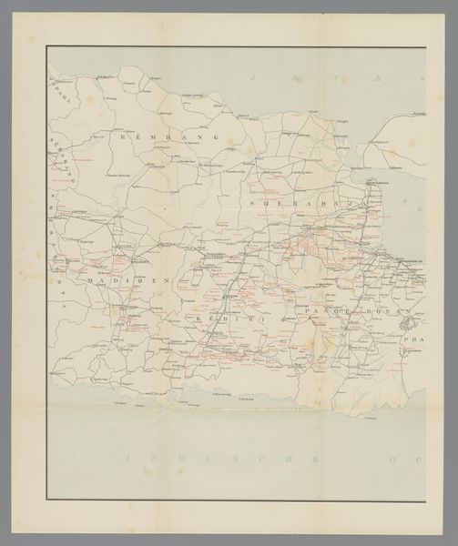
Dimensions: height 301 mm, width 835 mm
Copyright: Rijks Museum: Open Domain
This is an anonymous railway map of Java, charting a landscape undergoing transformation. Produced during a period of Dutch colonial rule, the map is not merely a geographical tool, but a document reflecting the power dynamics of the time. Consider how the railways, marked by stark lines across the island, facilitated the extraction of resources and the control of territory. This infrastructure, while presented as progress, deeply impacted the lives and lands of the Javanese people. The map’s visual language speaks of a desire to organize, control, and exploit the natural resources of the island. Notice, too, what is left unsaid. The absence of indigenous perspectives or narratives speaks volumes about the colonial gaze and the erasure of local agency. The map stands as a reminder of the complex and often painful intersections of progress, power, and identity.
Comments
No comments
Be the first to comment and join the conversation on the ultimate creative platform.
More like this