1726
Plattegrond van Belle Ile, 1726
Anonymous
@anonymousLocation
RijksmuseumListen to curator's interpretation
Curatorial notes
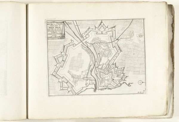
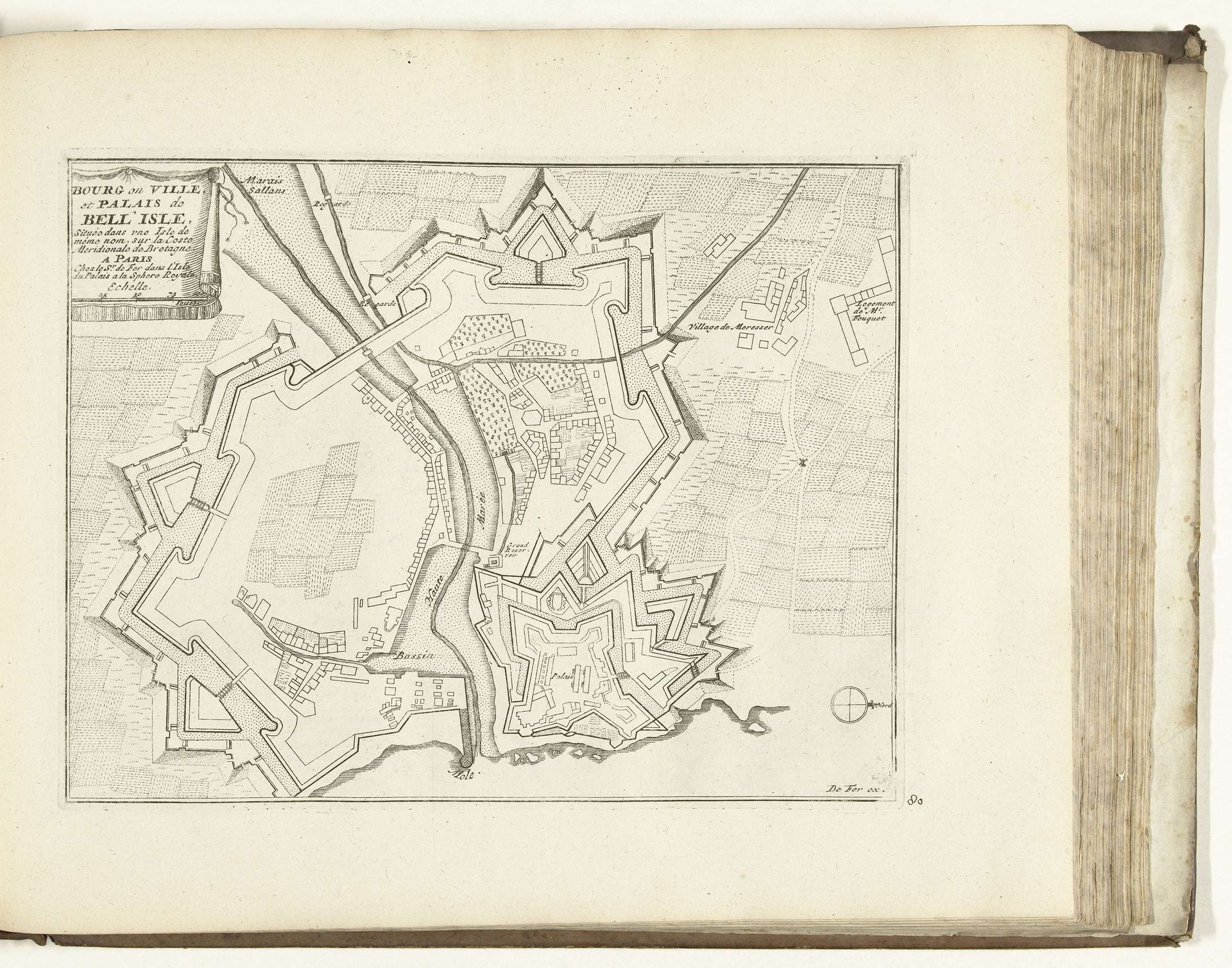
This is an anonymous map of Belle-Île, created in 1726, employing ink on paper. The composition is dominated by intricate, geometric patterns forming a detailed layout of the island’s fortifications and urban areas. The use of precise lines and calculated angles conveys a sense of order and strategic planning, revealing an intent to structure and control space. The map’s stark linearity highlights the rational approach of the cartographer. The island is represented not as a natural landscape, but as a constructed environment, designed to manage and defend its territory. This approach echoes broader philosophical concerns of the Enlightenment, where reason and order were valued. The map functions as a semiotic system, where each line, shape and symbol carries specific information. Roads, buildings, and natural elements, are all codified into a visual language. It suggests a world that is understandable and manipulable through rational thought. As you observe the structure, consider how it embodies the philosophical values and power dynamics of its time.