drawing, print, paper, ink, engraving
#
drawing
#
aged paper
#
toned paper
#
baroque
#
mechanical pen drawing
# print
#
pen sketch
#
paper
#
personal sketchbook
#
ink
#
geometric
#
ancient-mediterranean
#
pen-ink sketch
#
pen and pencil
#
pen work
#
sketchbook drawing
#
cityscape
#
sketchbook art
#
engraving
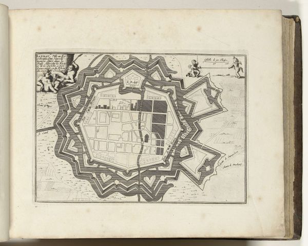
Dimensions: height 195 mm, width 275 mm
Copyright: Rijks Museum: Open Domain
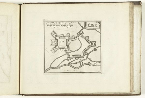
This is an anonymous print of a city plan of Landau, made in 1726. City plans, like portraits, are products of civic pride and government investment. They're tools to communicate power and instill confidence, both for residents and potential invaders. Here, the rigid geometric forms speak to the Enlightenment's emphasis on order and control. Landau, in what is now Germany, was at the time a French territory and a strategic military site. Notice the fortress-like layout, a visual code that tells us this city was built for defense. The Vauban-style fortifications, with their angular projections, were cutting-edge military engineering, designed to withstand cannon fire. To truly understand this map, we might look at military archives and engineering treatises, learning about siege warfare and the history of Landau itself. Art provides us with the material expression of the power of institutions at any given moment in time.
Comments
No comments
Be the first to comment and join the conversation on the ultimate creative platform.
More like this