drawing, print, paper, ink, engraving
#
drawing
#
baroque
# print
#
paper
#
ink
#
geometric
#
pen and pencil
#
sketchbook drawing
#
cityscape
#
watercolour illustration
#
history-painting
#
engraving
Dimensions: height 103 mm, width 151 mm, height 532 mm, width 320 mm
Copyright: Rijks Museum: Open Domain
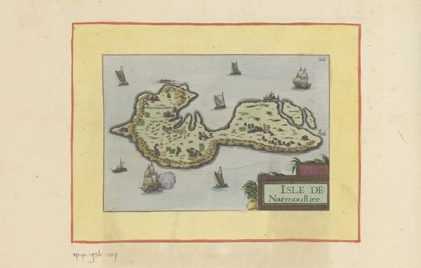
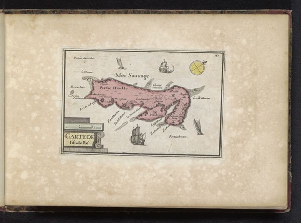
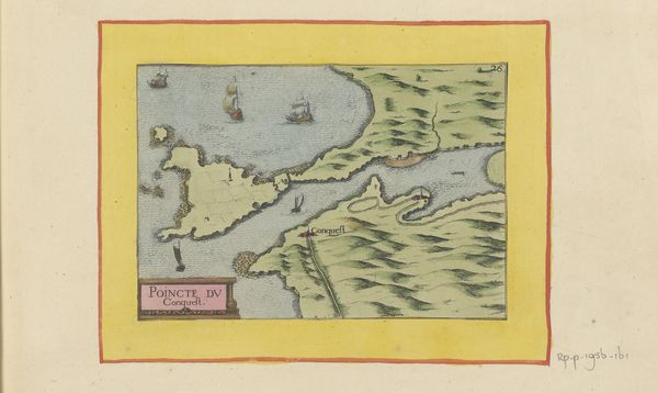
Curator: Immediately striking is the balance between its geometric precision and decorative flourishes. Editor: This is "Kaart van l'Île de Ré," a map created in 1638. It’s rendered in ink and engraving on paper. It provides us with an aerial perspective of the island and the surrounding waters. Curator: The use of line is fascinating. Look at the contrast between the delicate lines defining the coastline and the bolder lines used for the title cartouche. I see ships and wind roses as integral parts of the composition. How were these materials sourced? How was the labour divided in the production of such a map? Editor: These maps were not just aesthetic objects. This was commissioned and consumed in relation to military conflict on the island, informing strategies for naval blockades and troop movements. The materials were available through mercantile routes controlled by powerful state actors. Consider the role of these artisans as skilled labourers contributing to that history. Curator: Let's not reduce this map to just a record of war and colonial resource allocation. I am drawn to how space is represented, the way the island is rendered with surprising detail, creating a sense of depth and distance through precise drafting and subtle shading. Editor: But that very rendering served to impose a certain worldview, a mode of control over a territory and its inhabitants. Think about the labour of the sailors, the cartographers, and the engravers. Each stage of production reflects power relations and colonial ambitions. Curator: Yes, but that geometric rendering is also aesthetically compelling! How else does it fit into a Baroque visual lexicon? Editor: True, and those aesthetics served the purpose of communicating specific geographic knowledge for strategic ends, embedded as they are in the systems of resource extraction, colonization, and military action. Curator: This map, with its visual tension, asks us to confront history and appreciate craft. Editor: A sobering testament to the interplay of art, power, and production, revealing a world where even beauty served political purposes.
Comments
No comments
Be the first to comment and join the conversation on the ultimate creative platform.
More like this