#
aged paper
#
toned paper
#
ink paper printed
#
old engraving style
#
personal sketchbook
#
ink colored
#
sketchbook drawing
#
watercolour illustration
#
sketchbook art
#
watercolor
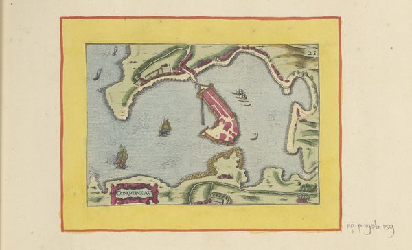
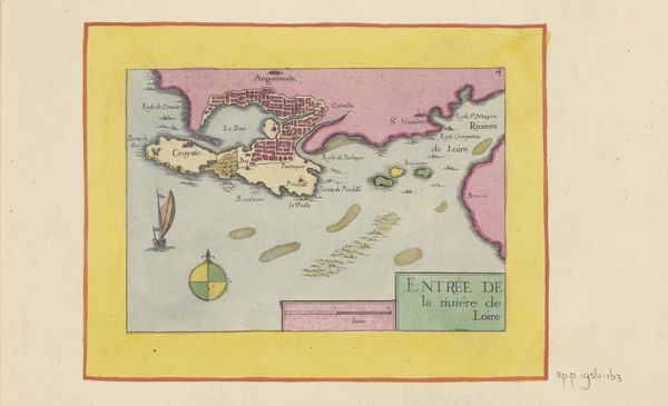
Dimensions: height 104 mm, width 151 mm, height 532 mm, width 320 mm
Copyright: Rijks Museum: Open Domain
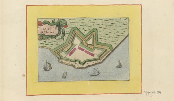
This is an anonymous map of Le Conquet. The structure of the composition immediately draws our attention to the interplay between the land and sea. The land is depicted in undulating greens, while the sea is rendered in soft blues, creating a contrast that highlights their distinct natures. The use of color isn't just descriptive; it organizes the visual space, guiding our eyes across the composition and revealing the strategic importance of the port through the ships. The scale of the ships provides a certain perspective by which to view the importance of the port. Maps aren't simply objective representations of space but are also instruments of power. The act of mapping itself is an assertion of control, delineating territories and establishing boundaries. This map, with its careful attention to detail, serves not only as a guide but also as a statement of dominance and a visual encoding of political and economic interests.
Comments
No comments
Be the first to comment and join the conversation on the ultimate creative platform.
More like this