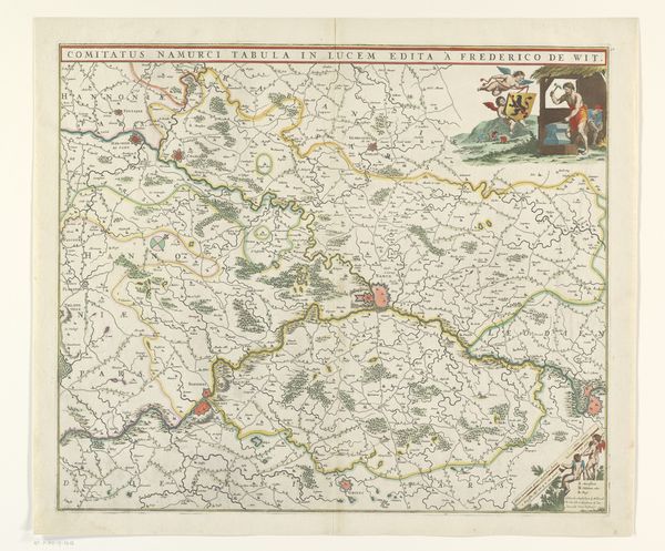
graphic-art, print, engraving
graphic-art
baroque
landscape
cityscape
engraving
Dimensions: height 387 mm, width 503 mm
Copyright: Rijks Museum: Open Domain
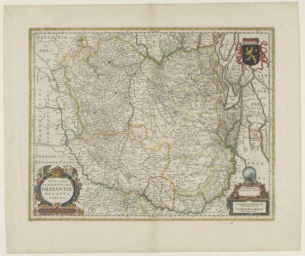
Curator: Looking at this intricate map, it strikes me as more than just geographical record. We have before us "Kaart van de graafschappen Henegouwen en Namen," a Baroque engraving from between 1666 and 1675, currently residing in the Rijksmuseum. Editor: The immediate impression is one of detail and perhaps… formality. It feels very controlled. The lines are so precise; there is such intentionality that seems to speak of power and control, a deliberate staking of claim. Curator: Precisely. These maps served multiple purposes, solidifying claims of ownership for those in power and facilitating administrative control. Cartography has historically been so intertwined with statecraft. Each contour, river, and town represented signifies not just geographic accuracy but also socio-political influence. Editor: I see that immediately, especially if you factor in what wasn't being depicted. It reminds me of how even landscape painting from the era also functioned within very gendered systems and power dynamics, that same staking of place and possession is very apparent here. I wonder about its use in maintaining the socio-political structure of the time. What were people thinking and experiencing as they viewed such depictions of 'their land?' Curator: It speaks volumes, doesn't it? These detailed maps were not accessible to the everyday person. It was carefully constructed to illustrate and enforce a specific worldview, defining territories, and implicitly codifying power structures. It subtly reinforced who belonged and who was governed. Editor: Considering it is an engraving and a print, who had access? These would've circulated within quite elite circles I imagine. We should also discuss that ornate Baroque detailing – is this purely decorative, or does it signal wealth, knowledge, access… dominance? Curator: Good questions. Yes, access was certainly limited, often destined for administrative use, libraries, and elite personal collections. The embellishments certainly are symbolic. It adds an aesthetic appeal. Editor: Well, viewing this work underscores the powerful connections between cartography, power, and representation, prompting us to look closer at the social ramifications of mapmaking throughout history. Curator: I couldn’t agree more. What initially appears as a static, historical document continues to speak volumes about governance, power, and the socio-political currents that shape our world.
Comments
No comments
Be the first to comment and join the conversation on the ultimate creative platform.