drawing, print, etching
drawing
aged paper
toned paper
light pencil work
etching
pencil sketch
landscape
etching
personal sketchbook
geometric
pen work
sketchbook drawing
sketchbook art
Dimensions: height 664 mm, width 1059 mm
Copyright: Rijks Museum: Open Domain
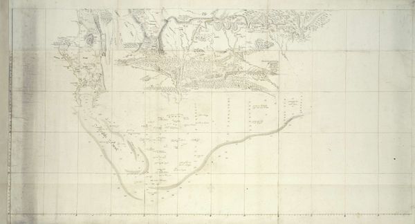
Daniël Veelwaard created this map of the Land van Heusden en Altena, but the date of its creation is unknown. It’s a detailed composition primarily using thin, dark lines on a pale background to define geographical boundaries, waterways, and land divisions. This gives the map an overall delicate yet precise feel. The visual structure relies on the contrast between the linear elements and the empty spaces, inviting you to consider the relationships between them. The lines demarcate territories, while the blank spaces evoke a sense of openness. The map visualizes territory, it also presents a structured view of land ownership, administrative control, and geographical knowledge. The cartographer is not merely recording space but also encoding it with social and political meaning. The map is an assertion of control and understanding, a visual manifestation of power over the depicted territory.
Comments
No comments
Be the first to comment and join the conversation on the ultimate creative platform.