drawing, print, paper, ink, engraving
#
drawing
#
baroque
# print
#
perspective
#
paper
#
ink
#
cityscape
#
engraving
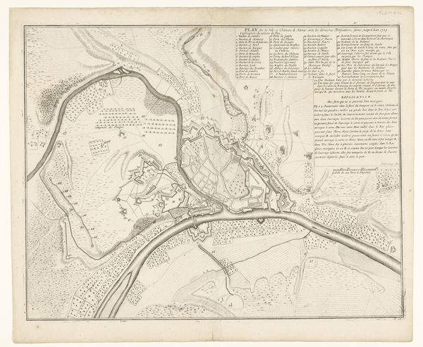
Dimensions: height 447 mm, width 566 mm
Copyright: Rijks Museum: Open Domain
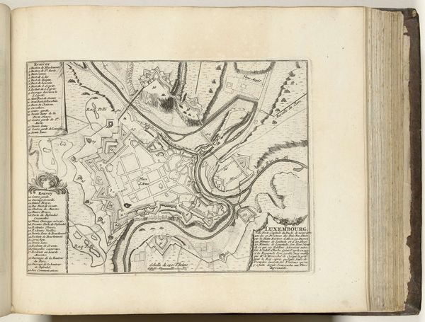
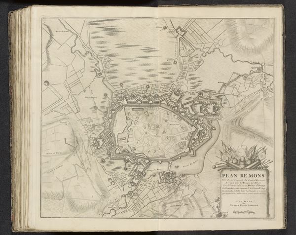
Curator: This meticulously detailed work is Jacobus Harrewijn's "Plattegrond van Namen, 1709," an engraving executed in ink on paper, currently residing in the Rijksmuseum collection. Editor: Immediately, I am struck by its complex network of lines; the topography is captured with incredible precision! A fascinating display of the engraver's skill. Curator: Indeed. Harrewijn presents not just the urban layout but also a discourse on 18th-century warfare. This plan offers strategic insights into the city’s defenses, essential knowledge during times of conflict. The grid-like organization speaks to enlightenment ideals of order and control. Editor: It does convey a certain sense of imposing order over the land, and yet, despite its precision, I detect a tension, perhaps born from the anticipation of siege or conflict rendered visible through form and line. Note how the Baroque penchant for dramatic perspective amplifies the effect, lending depth to the scene and drawing us into the landscape. Curator: Baroque influences are undeniable, but the drawing serves primarily as a functional artifact—a military blueprint, intended to inform, plan, and strategize. The elegance might, in fact, reflect a broader trend in cartography of the era. The artist’s intention lies in communicating practical geographic information, rather than aesthetics. Editor: Perhaps the dichotomy enriches the work; its beauty stemming from functionality is undeniably satisfying. Notice, too, how areas outside of the primary subject use minimal linework to convey information but leave room for interpretation. Curator: The engraving serves as a reminder of art’s public role. Maps like these weren’t just scientific documents; they were instruments of power. Their circulation informed not only military leaders but also shaped public perceptions of territory and dominion. Editor: An efficient representation of strategic planning. The lines direct not just our gaze, but potentially direct troop movements or military strategy. I am more informed after this deep visual investigation. Curator: Absolutely. Studying "Plattegrond van Namen" reminds us that even seemingly objective representations like maps are deeply embedded within specific historical and social frameworks.
Comments
No comments
Be the first to comment and join the conversation on the ultimate creative platform.
More like this