drawing, paper, ink
#
drawing
#
landscape
#
paper
#
ink
#
geometric
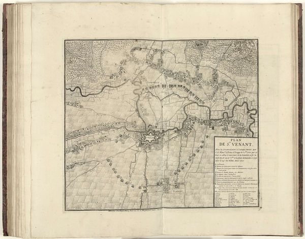
Dimensions: height 415 mm, width 470 mm
Copyright: Rijks Museum: Open Domain
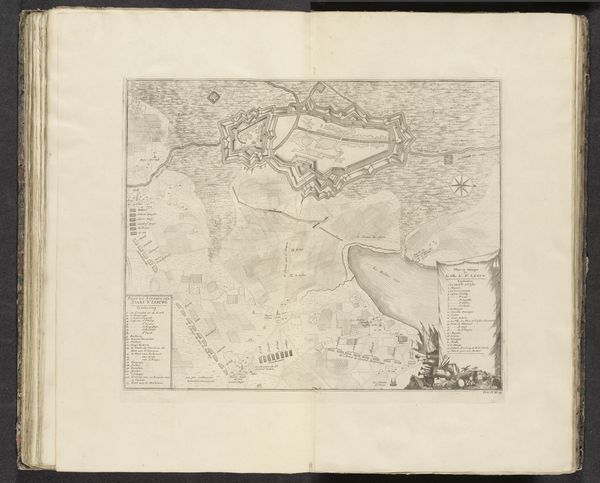
This is an anonymous map of the siege of Saint-Venant, created in 1710. The drawing presents a bird's-eye view of the town and its surrounding fortifications, rendered with meticulous detail and precision. Observe how the cartographer utilizes a restrained palette, focusing on the stark contrast between the paper and the fine, delicate lines that define the landscape. These lines trace the complex network of walls, moats, and defensive structures, revealing the strategic layout of the town. The composition emphasizes geometric forms, from the star-shaped fortresses to the grid-like pattern of fields, reflecting the Enlightenment's emphasis on reason and order. Yet, this map is more than a mere representation of space; it embodies the power and knowledge inherent in visualizing and controlling territory. The map serves as a semiotic system, encoding military and political meanings through its visual language. The strategic deployment of lines and shapes reflects not only the physical layout but also the underlying power structures.
Comments
No comments
Be the first to comment and join the conversation on the ultimate creative platform.
More like this