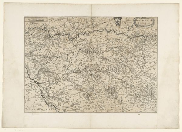
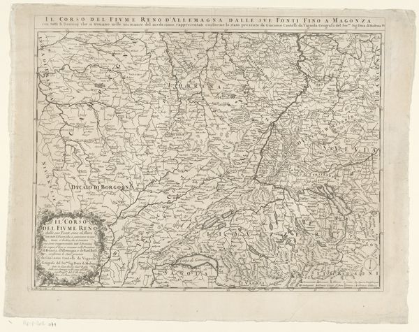
Kaart van het hertogdom Limburg en een deel van het bisdom Luik 1686 - 1727
jacobusharrewijn
Rijksmuseum
print, etching
dutch-golden-age
etching
landscape
etching
cityscape
Dimensions: height 591 mm, width 488 mm
Copyright: Rijks Museum: Open Domain
Jacobus Harrewijn created this map of the Duchy of Limburg and part of the Bishopric of Liège using etching techniques. At first glance, one is struck by the intricate network of lines, meticulously mapping out the region's topography. The monochromatic palette enhances the clarity of the map's detailed features, from meandering rivers to the structured layouts of towns and cities. The composition adheres to a grid-like structure, reflecting an Enlightenment era emphasis on reason and order. This map is not merely a geographical tool; it is a symbolic representation of power and knowledge. The precise lines and detailed inscriptons act as signs, encoding the region's resources and strategic importance. Cartography during this period served both practical and ideological purposes. It shaped perceptions of territory and ownership. The inclusion of heraldic symbols further underscores the map's role in asserting authority. Note the tension between scientific accuracy and artistic expression, challenging the viewer to consider how form and function intersect within cartographic representation.
Comments
No comments
Be the first to comment and join the conversation on the ultimate creative platform.