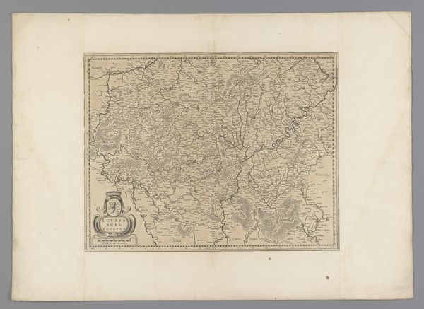
graphic-art, print, engraving
graphic-art
baroque
ink paper printed
landscape
engraving
Dimensions: height 406 mm, width 561 mm
Copyright: Rijks Museum: Open Domain
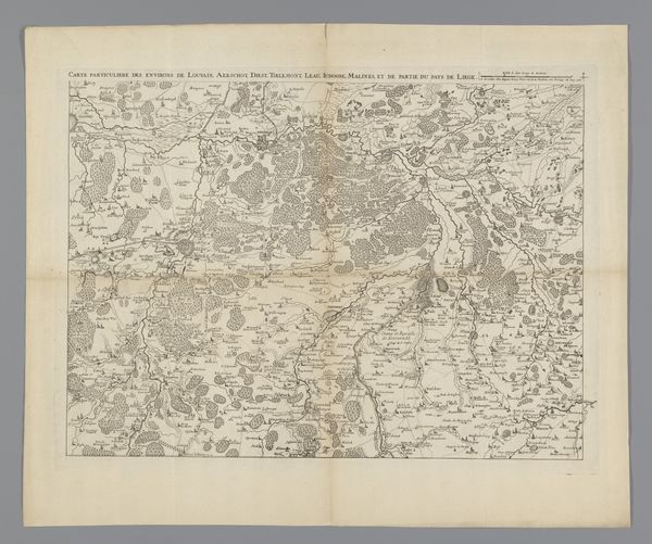
Curator: Looking at this map, I feel a certain quiet curiosity—a whispered promise of forgotten paths and whispered place names. There's a dense network of lines, like the veins of a leaf, evoking a world carefully mapped and measured. Editor: This engraving, "Kaart van het hertogdom Gulik," dating from roughly 1636 to 1680, offers more than just a visual record; it's a statement of power and control. Anonymous, yes, but the hand behind it served specific geopolitical interests. Curator: Oh, absolutely, the formal stiffness is there—but look closer. There's a delicate dance of light and shadow; tiny villages clustered like secrets shared between hills. I feel invited to wander through this landscape in my mind, untethered to the strategic intents, if only for a little while. Editor: But to untether oneself completely would be a mistake. These maps are not innocent records of topography. The very act of mapping normalizes spatial control and claims. Who held the power to define borders, to name places, to represent the landscape in a particular way? These choices serve the agenda of those in charge. Curator: Agreed, I acknowledge the undeniable thread of colonialism running through so many landscapes memorialized this way. But doesn’t art hold multitudes? A beautiful, terrifying duality. Can’t it just be…beautiful…also? Editor: Well, that depends on your definition of beauty! Acknowledging power dynamics does not diminish artistic skill. The baroque style in this landscape presents idealized depictions. This art demands that we unpack the assumptions of cartography in the seventeenth century. Think of how maps continue to affect displacement today. Curator: Okay, I see your point. I have let my whimsical tendencies pull me a little far! This old map and its lines... it seems like a coded promise, both grand and melancholic. Editor: Maps offer a seductive claim of certainty amidst profound uncertainties. They invite you to follow familiar paths and also interrogate forgotten narratives and historical blind spots.
Comments
No comments
Be the first to comment and join the conversation on the ultimate creative platform.