print, etching
#
16_19th-century
# print
#
etching
#
etching
#
realism
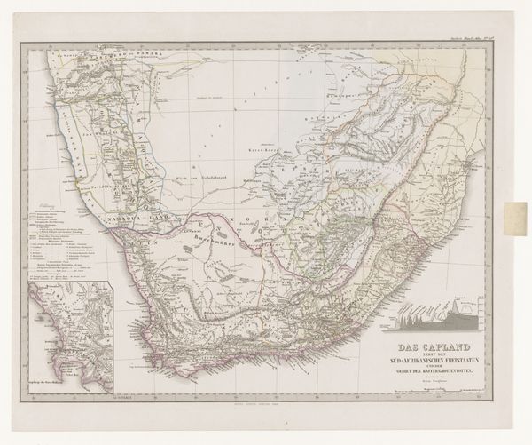
Dimensions: height 371 mm, width 446 mm
Copyright: Rijks Museum: Open Domain
Curator: This etching, "Kaart van Zuid-Afrika met de voormalige Kaapkolonie" by Carl Jungmann from 1867, is intriguing, don’t you think? Editor: It really is. The detail achieved through etching is remarkable. Looking at it, it strikes me as more than just a map. How should we approach interpreting something like this? Curator: From a materialist perspective, we can analyze the very process of its creation. What does it mean to reproduce South Africa through the labor-intensive method of etching in the 19th century? What materials were readily available to Jungmann and his workshop? Consider the role of colonialism in facilitating both the production and dissemination of this map. Editor: So, the paper, the etching tools, the ink—and then, who would be purchasing and using this map? Curator: Exactly! Consider how the map itself becomes a commodity. How is the land itself being presented as something that can be owned or controlled? Is the etching technique maybe chosen because of its capacity to facilitate replication and wide circulation across the globe? Editor: I hadn’t considered it as an object meant for distribution and consumption, framing South Africa in a specific, colonially driven way. It highlights the labor, the accessibility of the means of making art at this time, and its market. Curator: Precisely. Think about what this map *does* rather than simply what it depicts. How does its materiality reinforce or even enable particular social and economic relationships? Editor: I'm definitely going to be looking at art with a much more critical eye towards materials and labor from now on. Thank you for showing me a new dimension. Curator: Likewise. It’s in understanding how things are made and circulated that we start to truly understand their meaning.
Comments
No comments
Be the first to comment and join the conversation on the ultimate creative platform.
More like this