graphic-art, print, engraving
#
graphic-art
#
dutch-golden-age
# print
#
landscape
#
geometric
#
engraving
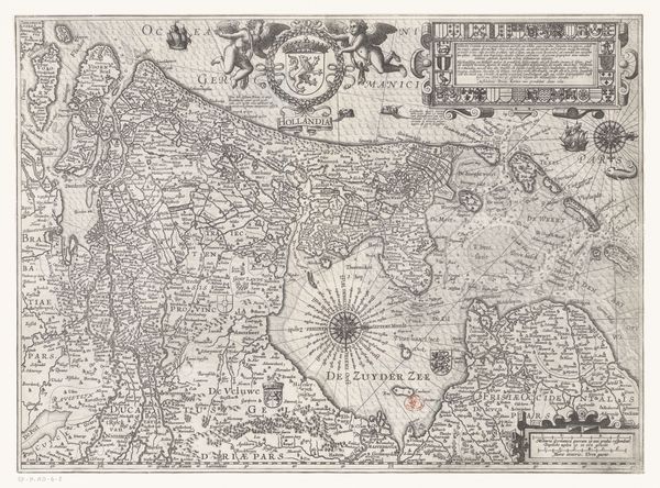
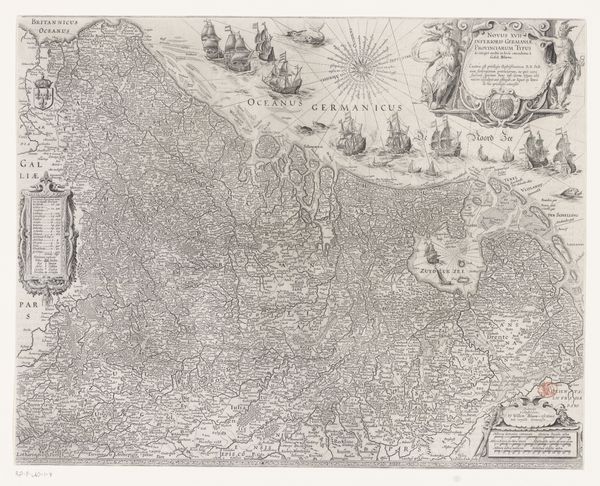
Dimensions: height 386 mm, width 502 mm
Copyright: Rijks Museum: Open Domain
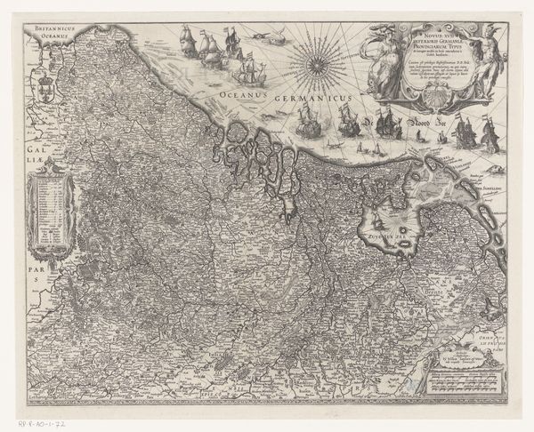
This is Pieter van der Keere's 'Kaart van de Zeventien Provinciën', a detailed map created around the early 17th century. Executed with fine lines and intricate detail, the map offers an aesthetic experience characterized by dense information and subtle contrasts. The structure of the map reveals a careful arrangement of geographic and symbolic elements. Note how the landmass is framed by decorative cartouches, compass roses, and sailing ships, each placed to balance the visual weight across the composition. The density of place-names, borders, and topographical features creates a rich, almost textured surface, indicative of a period where cartography blended scientific accuracy with artistic expression. What's intriguing here is how this map operates beyond mere geographical representation. The map uses a semiotic system where icons and text function as signs, communicating not just location but also claims of ownership and cultural identity. Its formal qualities, therefore, reflect broader political and philosophical concerns about territory, knowledge, and power during a time of intense European exploration and state formation.
Comments
No comments
Be the first to comment and join the conversation on the ultimate creative platform.
More like this