print, engraving
#
dutch-golden-age
# print
#
pen illustration
#
pen sketch
#
old engraving style
#
landscape
#
geometric
#
line
#
engraving
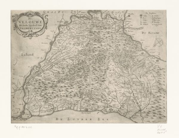
Dimensions: height 384 mm, width 517 mm
Copyright: Rijks Museum: Open Domain
This is an anonymous map of the Veluwe region, created to chart a territory, but it also speaks volumes about identity. Look at the compass rose at the bottom. It’s more than a navigational tool; it's an emblem of exploration, a psychological yearning to understand and control our environment. From ancient mariners to modern explorers, the compass symbolizes our innate drive to map the unknown. The two decorative cartouches on either side feature coats of arms. These are more than heraldic devices; they are symbols of power, lineage, and cultural memory. Throughout history, we find similar emblems in royal seals, family crests, and even corporate logos, each a visual shorthand for belonging and authority. These symbols tap into our collective subconscious, evoking feelings of pride and loyalty. Such symbols remind us that cartography is never a neutral act. It’s always imbued with layers of cultural, political, and deeply personal meaning.
Comments
No comments
Be the first to comment and join the conversation on the ultimate creative platform.
More like this