About this artwork
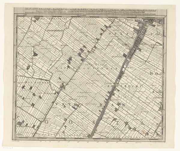
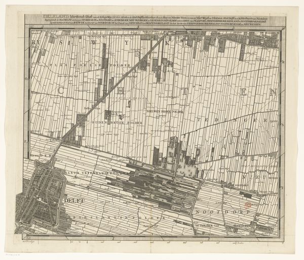
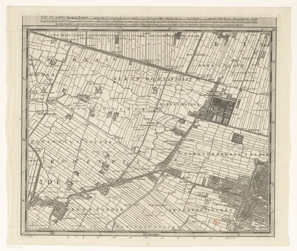
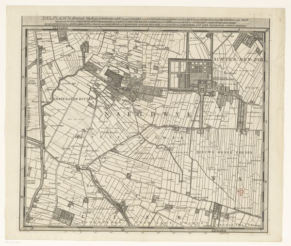
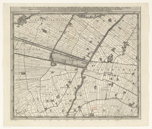
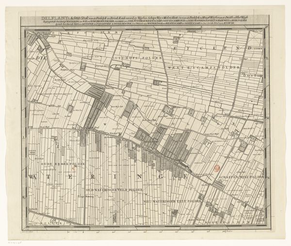
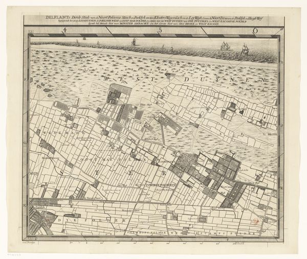
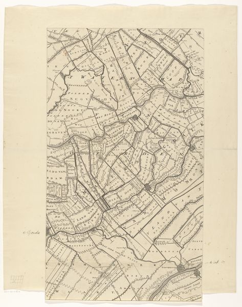
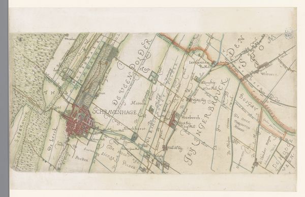
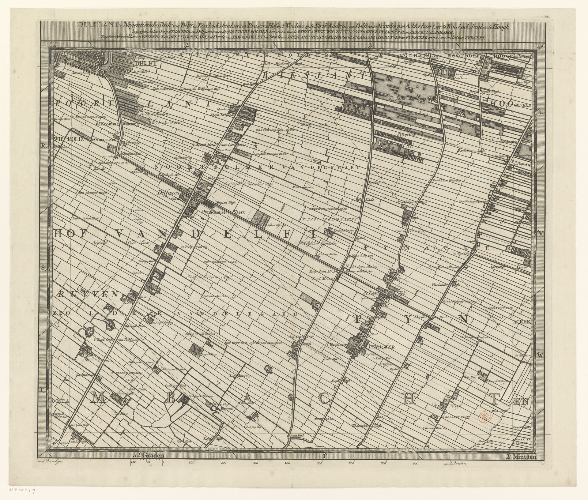
Curator: This etching offers a meticulous rendering of the Delfland region. It's titled "Kaart van het Hoogheemraadschap van Delfland (negentiende deel)", created between 1712 and 1735. The author is Luggert van Anse. Editor: It looks like someone sketched their dream farmland...or maybe it’s more about control than dreams. There’s a real sense of imposed order. Curator: Precisely. The very act of mapping is about imposing a certain order, a framework, onto the land. Notice the tight grid of lines, the density of detail. It's less about the romantic ideal of landscape and more about surveying and delineating property. It reads as an attempt to codify the terrain for administrative or possibly legal purposes. Editor: Sure, order, authority, all that. But the lines, those repeated horizontals and verticals... it’s almost musical, isn’t it? A score for the landscape? A little repetitive, maybe needing a bit of syncopation, but definitely humming with a certain graphic rhythm. It almost doesn’t feel real, like peering into an intensely cultivated alternate reality. Curator: That's interesting. You're perceiving the repetition as rhythm, where I see the systematic nature as inherently rigid and geometric. Editor: But consider the texture, the very slightly rippled, aged surface of the paper, the way the ink bleeds ever so slightly, it introduces a little organic chaos into the geometric. That contrast is what grabs me. Curator: True. The materiality of the etching counters the absolute rationality of the design. And from the perspective of semiotics, the map itself becomes a sign. A complex symbolic system denoting territory, power, and even the Dutch mastery of land reclamation. Editor: I still keep getting caught on all these tight geometries and repetitive patterns – kind of gives the sense of how regulated their existence and worldview must have been. Makes me feel like running to find the wildest and most unruly space imaginable! But I appreciate this rigid order; it allows my mind to consider the context. Curator: Indeed, that is what Dutch Golden Age map making provides – and maybe more – for our modern sensibilities. Editor: Agreed. It’s a useful thing to observe these older attempts to shape, quite literally, both their lands and minds.
Kaart van het Hoogheemraadschap van Delfland (negentiende deel)
1712 - 1735
Artwork details
- Medium
- graphic-art, print, etching, engraving
- Dimensions
- height 515 mm, width 594 mm
- Copyright
- Rijks Museum: Open Domain
Tags
Comments
Share your thoughts
About this artwork
Curator: This etching offers a meticulous rendering of the Delfland region. It's titled "Kaart van het Hoogheemraadschap van Delfland (negentiende deel)", created between 1712 and 1735. The author is Luggert van Anse. Editor: It looks like someone sketched their dream farmland...or maybe it’s more about control than dreams. There’s a real sense of imposed order. Curator: Precisely. The very act of mapping is about imposing a certain order, a framework, onto the land. Notice the tight grid of lines, the density of detail. It's less about the romantic ideal of landscape and more about surveying and delineating property. It reads as an attempt to codify the terrain for administrative or possibly legal purposes. Editor: Sure, order, authority, all that. But the lines, those repeated horizontals and verticals... it’s almost musical, isn’t it? A score for the landscape? A little repetitive, maybe needing a bit of syncopation, but definitely humming with a certain graphic rhythm. It almost doesn’t feel real, like peering into an intensely cultivated alternate reality. Curator: That's interesting. You're perceiving the repetition as rhythm, where I see the systematic nature as inherently rigid and geometric. Editor: But consider the texture, the very slightly rippled, aged surface of the paper, the way the ink bleeds ever so slightly, it introduces a little organic chaos into the geometric. That contrast is what grabs me. Curator: True. The materiality of the etching counters the absolute rationality of the design. And from the perspective of semiotics, the map itself becomes a sign. A complex symbolic system denoting territory, power, and even the Dutch mastery of land reclamation. Editor: I still keep getting caught on all these tight geometries and repetitive patterns – kind of gives the sense of how regulated their existence and worldview must have been. Makes me feel like running to find the wildest and most unruly space imaginable! But I appreciate this rigid order; it allows my mind to consider the context. Curator: Indeed, that is what Dutch Golden Age map making provides – and maybe more – for our modern sensibilities. Editor: Agreed. It’s a useful thing to observe these older attempts to shape, quite literally, both their lands and minds.
Comments
Share your thoughts