print, engraving
#
baroque
#
dutch-golden-age
# print
#
landscape
#
geometric
#
line
#
cityscape
#
engraving
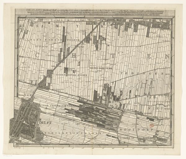
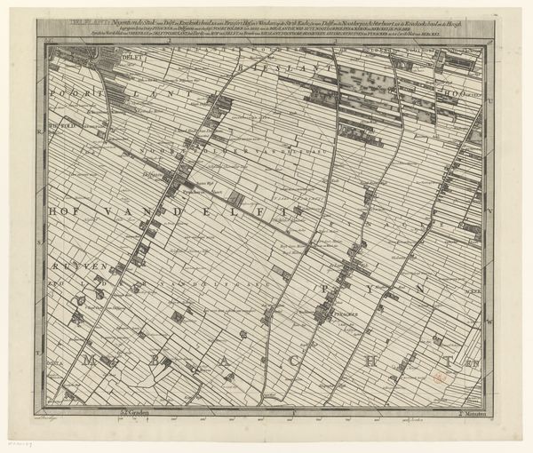
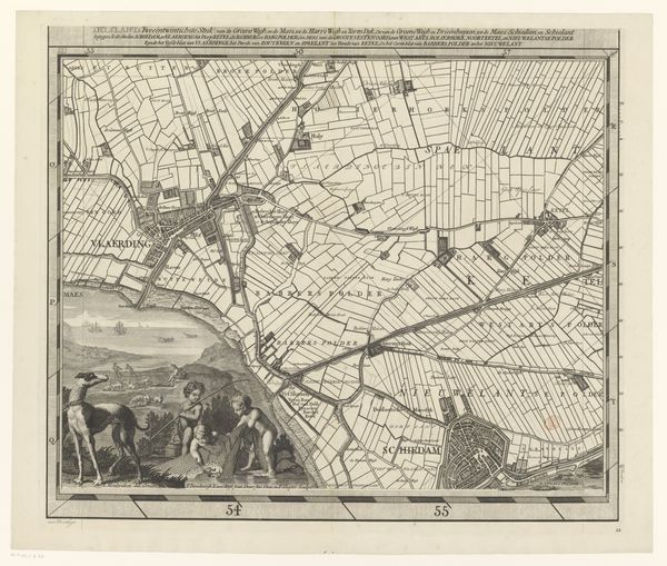
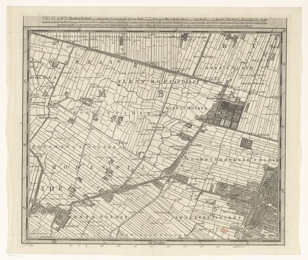
Dimensions: height 517 mm, width 595 mm
Copyright: Rijks Museum: Open Domain
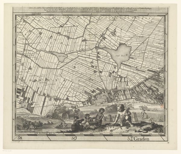
Curator: The eye is immediately drawn to this piece. It's an antique map of the Delfland region, made between 1712 and 1735 by Luggert van Anse. Look at the precision; it’s all lines and angles, done through engraving, probably on copperplate. Editor: You know, at first glance, I'm overwhelmed, almost in a good way. The geometry…it's mesmerizing, hypnotic even. But also… slightly claustrophobic? Is that weird? All those neatly packed rectangles. Curator: Not weird at all! These shapes showcase polders, lands reclaimed from water. The whole region wrestles with the sea. Van Anse wasn't just drawing pretty lines; he was documenting land management, the literal shaping of a nation. See the lighter areas represent waterways, dunes and coastal areas where little geometry can be enforced. Editor: It’s that contrast, the push and pull, I think that grabs me. Order imposed, but with nature breathing through. The detail is phenomenal. It feels… well, scientific. Like I could use this to, I don't know, survey something. What else jumps out for you, beyond the geometry? Curator: The cityscape aspect, especially how it merges with landscape. This wasn't just about acreage; people lived here. There's baroque influence, in the ornamental aspects and even the drama. Consider the light, even etched, how land emerges from shadow. Editor: Mmm, a point well-etched, wouldn't you say? Ha! Okay, bad pun aside, it IS visually striking. So orderly, so rational. In an age of such grand artistic flourishes, someone taking a practical need for land oversight and turning it into an oddly affecting statement? Beautiful and functional colliding. Curator: Precisely. It encapsulates Dutch Golden Age ideals. Pride in accomplishment, mastery over nature. It’s a blend of cartography and artistry and offers much for reflection, for both geographers and art enthusiasts, and you've touched on what truly speaks to me, also: the sheer artistic quality. Editor: It feels significant beyond just being a map. Like a testament, a…drawing a line in the sand, or should I say, a line in the marsh? Thanks for unraveling that. I feel a bit less claustrophobic now and more, yeah, captivated.
Comments
No comments
Be the first to comment and join the conversation on the ultimate creative platform.
More like this