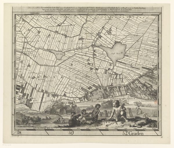
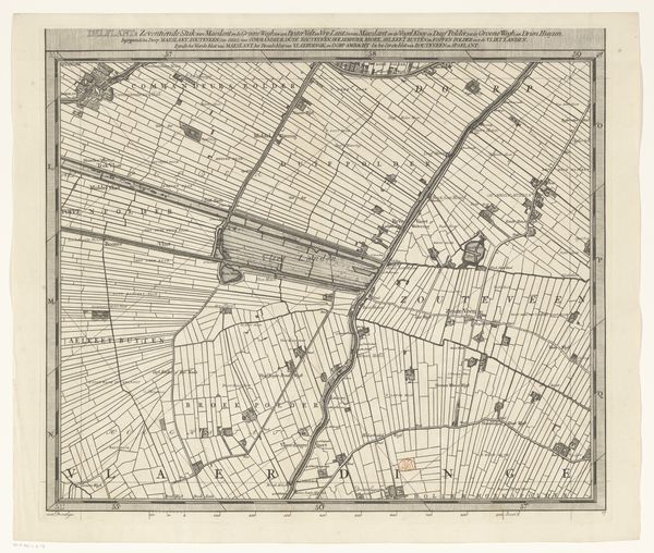
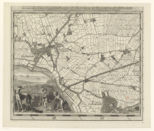
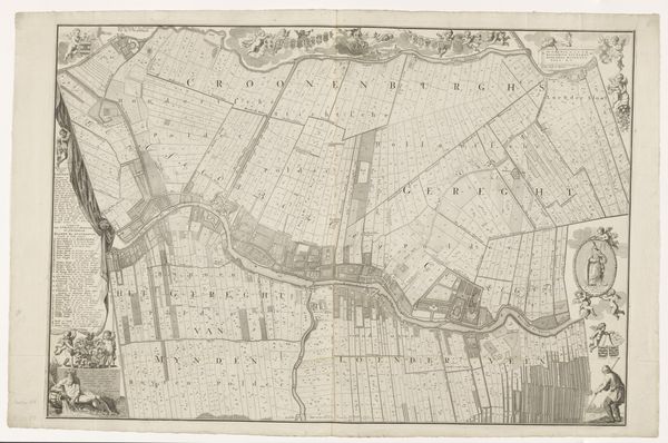
Kaart van het Hoogheemraadschap van Delfland (drieëntwintigste deel) 1712 - 1735
0:00
0:00
print, engraving
#
dutch-golden-age
# print
#
landscape
#
geometric
#
line
#
engraving
Dimensions: height 514 mm, width 594 mm
Copyright: Rijks Museum: Open Domain
This map of Delfland, a region in the Netherlands, was made by Luggert van Anse, using ink on paper. Look closely and you'll see that the print reveals more than just geographical data. The map shows not only the precise division of land, but also the intensive labor required to manage it. Each line, carefully etched, represents the human effort to drain and cultivate the land, pushing back against the natural flow of water. The flat, geometric shapes denote polders, or reclaimed land. These plots were hard-won, their creation dependent on the collaborative efforts of many. This was an era defined by intense agricultural production, with land ownership concentrated in the hands of a few. The map therefore becomes a record of social and economic relationships, hinting at the labor and class structures embedded in the landscape itself. The decision to create the map as a print makes it relatively reproducible and widely available for consultation. Therefore, it is not just a guide, but also a tool of governance, making visible the control of land and resources.
Comments
No comments
Be the first to comment and join the conversation on the ultimate creative platform.
More like this