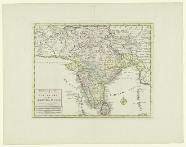
Kaart van India en westelijke kuststrook van Birma, Siam en Malakka met 8 bijkaartjes 1752
print, etching, engraving
neoclacissism
etching
old engraving style
landscape
etching
geometric
engraving
Dimensions: height 886 mm, width 1058 mm
Copyright: Rijks Museum: Open Domain
Jean Baptiste Bourguignon d’Anville created this map of India and the western coasts of Southeast Asia without noting the precise date of its creation. Maps were not neutral documents; they played a crucial role in shaping European perceptions and asserting control over distant lands. D'Anville was a prominent French geographer, and his work reflects the growing European interest in and colonial ambition towards India during the 18th century. This map, with its detailed coastlines and river systems, would have been invaluable for traders, missionaries, and military strategists, all of whom were vying for influence in the region. It’s important to remember that this map represents a European perspective, often prioritizing European interests and trade routes over indigenous knowledge and political boundaries. Historians often consult a variety of sources, including local records, travel accounts, and other maps, to gain a more nuanced understanding of the region and its history.
Comments
No comments
Be the first to comment and join the conversation on the ultimate creative platform.