print, etching, engraving
# print
#
pen sketch
#
etching
#
landscape
#
etching
#
engraving
Dimensions: height 580 mm, width 884 mm
Copyright: Rijks Museum: Open Domain
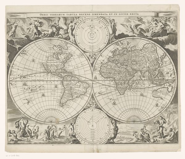
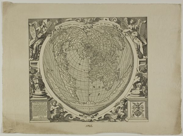
This is Cornelis van Baarsel's "World Map with the voyages of James Cook," likely created sometime around the late 18th or early 19th century. This map isn’t just a geographical tool; it's a cultural artifact that speaks volumes about European exploration and its impact on the world. The detailed routes of James Cook highlight Europe's growing reach and the narratives it constructed around discovery and colonialism. But what stories are missing from this map? What perspectives are overshadowed by this Western gaze? Consider the indigenous populations whose lands and lives were irrevocably altered by these voyages. Their knowledge, experiences, and very existence are marginalized in this representation. How does this map affect our understanding of history, and whose stories does it uplift or silence? The emotional weight of such historical omissions lingers, challenging us to reflect on the complex legacy of exploration.
Comments
No comments
Be the first to comment and join the conversation on the ultimate creative platform.
More like this