drawing, paper, ink
#
drawing
#
baroque
#
paper
#
ink
#
line
#
cityscape
Dimensions: height 221 mm, width 295 mm
Copyright: Rijks Museum: Open Domain
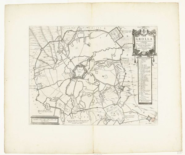
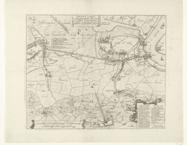
This is a map of Gent, created in 1726 by an anonymous artist, rendered in pen and ink on paper. The neutral palette focuses our attention on the intricate network of lines that define the city’s layout. Notice how the city is enclosed within a structured, almost geometric framework. Straight lines form roads and canals, intersecting to create distinct spaces, while the jagged lines of the fortifications around the city resemble teeth. The meticulous details and the stark contrast between the lines and the paper create a sense of clarity. Maps like this were not merely representations of space. They were tools of power, delineating territory and control. The map offers a vision of order and rationality, yet it also hints at the complex interplay of urban planning, military strategy, and social life. The rigid structure suggests that the city is a constructed entity, shaped by human intention and power dynamics. Consider how this ordered view invites us to contemplate the relationship between representation and reality, and the ways in which we impose structures upon the world around us.
Comments
No comments
Be the first to comment and join the conversation on the ultimate creative platform.
More like this