drawing, print, etching, engraving
#
drawing
#
baroque
# print
#
pen sketch
#
etching
#
cityscape
#
engraving
Dimensions: height 202 mm, width 273 mm
Copyright: Rijks Museum: Open Domain
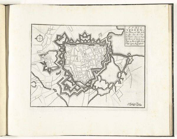
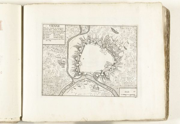
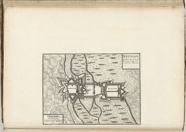
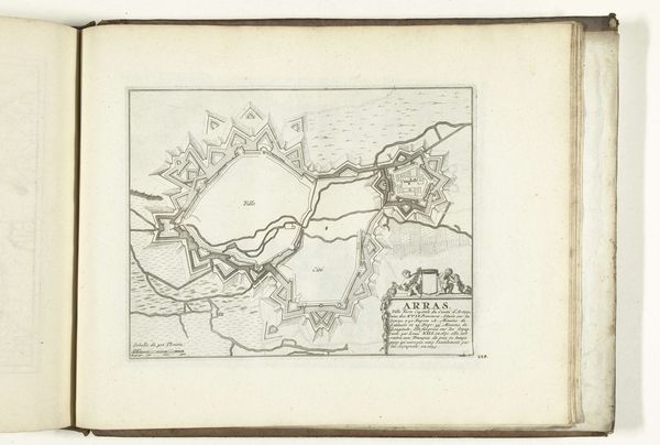
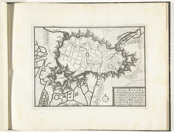
This is an early 18th-century map of Tournai, likely made by an anonymous printmaker using etching or engraving. The stark lines, achieved through pressing an inked plate onto paper, illustrate not just geography but also a particular way of seeing the world. Look closely, and you'll notice that the map prioritizes military fortifications. The elaborate star-shaped structures ringing the city speak to an age of conflict, where urban planning was as much about defense as it was about daily life. This wasn't just a neutral representation; it was a strategic document, instrumental for governance, military planning, and civic identity. The printmaking process itself is crucial here. Each line meticulously etched or engraved by hand. Every print pulled from the plate carries the weight of labor and the intent of mass communication. This map reminds us that even seemingly objective documents are the product of specific hands, tools, and social contexts. So next time you look at a map, consider who made it, how, and why.
Comments
No comments
Be the first to comment and join the conversation on the ultimate creative platform.
More like this