drawing, print, paper, engraving
#
drawing
# print
#
landscape
#
paper
#
11_renaissance
#
coloured pencil
#
geometric
#
engraving
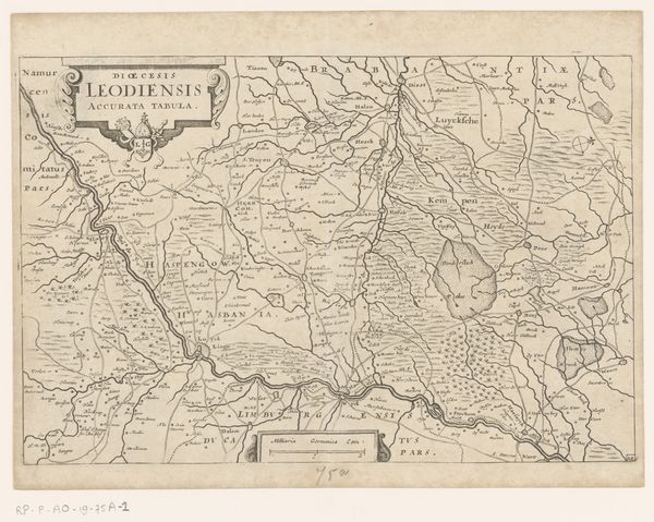
Dimensions: height 161 mm, width 235 mm
Copyright: Rijks Museum: Open Domain
Editor: So, here we have an early 18th-century map titled "Kaart van bisdom Luik," which translates to "Map of the Diocese of Liège." It's an anonymous engraving printed on paper, and the delicate coloring is really striking. I find myself wondering about the symbolic significance of maps at this time. What can you tell me about it? Curator: Maps are indeed rich in symbolism! This map, though seemingly utilitarian, is far more than just a geographical tool. Notice the way the territories are delineated; what emotions do the colours evoke? Editor: The pastel pinks and greens feel quite soft, almost inviting, rather than starkly defining borders. Curator: Precisely! Consider that this was produced during a time of shifting power dynamics. Maps like these helped to visualize and, in some ways, legitimize territorial claims and ecclesiastical authority. Does the use of Latin for ‘Dioecesis Leodiensis’ strike you as having a specific meaning for this visual object? Editor: It suggests an educated, perhaps religious, audience, reinforcing the Church's presence. The very act of mapping transforms the land into something that can be owned, understood, and controlled. What might have been lost in translation? Curator: A lot is left off of the map as we know it. But I see something gained through this approach. One question to leave us with: What psychological impact might this colored certainty have had on those who viewed it during this period? Editor: It definitely makes you consider the power of visual representation and its impact on shaping perceptions and solidifying identities. Thanks! Curator: A pleasure, indeed! It’s a reminder that even seemingly objective documents like maps are loaded with cultural meaning.
Comments
No comments
Be the first to comment and join the conversation on the ultimate creative platform.
More like this