print, engraving
#
neoclacissism
# print
#
cityscape
#
history-painting
#
engraving
Dimensions: height 263 mm, width 351 mm
Copyright: Rijks Museum: Open Domain
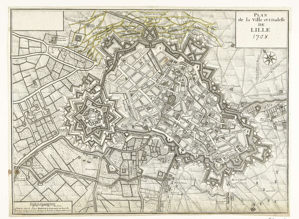
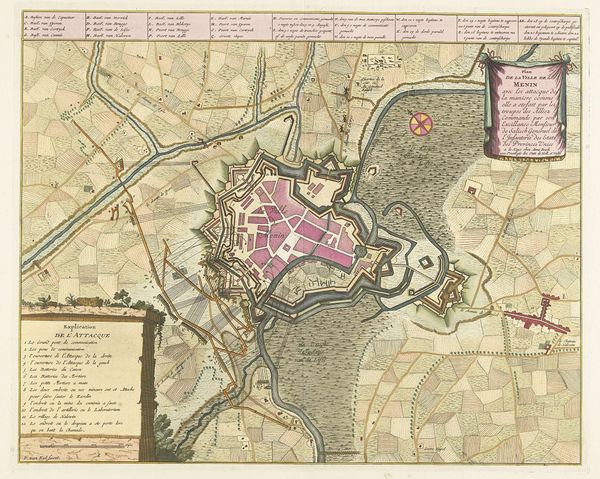
Cornelis van Baarsel created this print, Plan van de versterkingen van Rijssel, in 1794. It depicts a bird's eye view of the city of Lille in Northern France. The image creates meaning through its visual codes, cultural references, and historical associations. At this time, The Netherlands was in turmoil, with the Dutch Republic under pressure from both internal revolutionaries and external forces, such as France. Van Baarsel’s plan highlights Lille's military defenses, with its star-shaped fortifications and strategic layout, which emphasizes the importance of military planning during a time of political instability. The social conditions of the late 18th century shaped artistic production. Understanding the meaning of this print relies on historical context and research resources. It reflects the anxieties and priorities of a society on the brink of transformation, showing art's meaning as contingent on social and institutional context.
Comments
No comments
Be the first to comment and join the conversation on the ultimate creative platform.
More like this