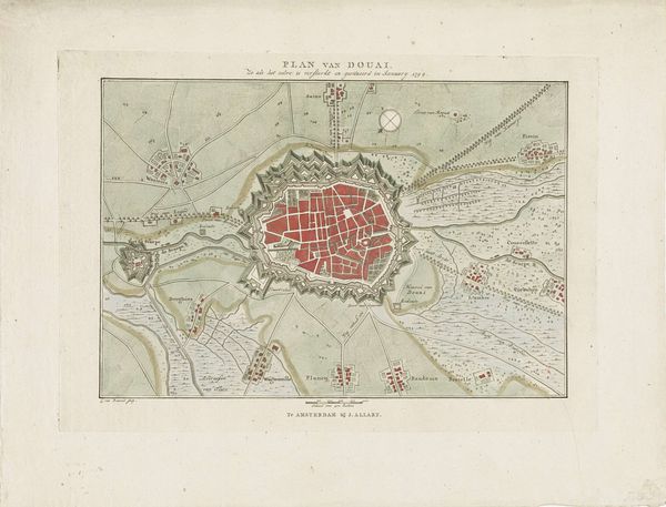
print, engraving
#
baroque
# print
#
cityscape
#
history-painting
#
engraving
Dimensions: height 480 mm, width 590 mm
Copyright: Rijks Museum: Open Domain
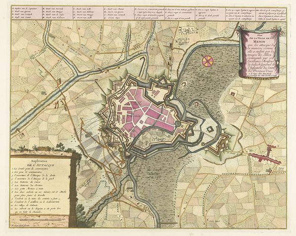
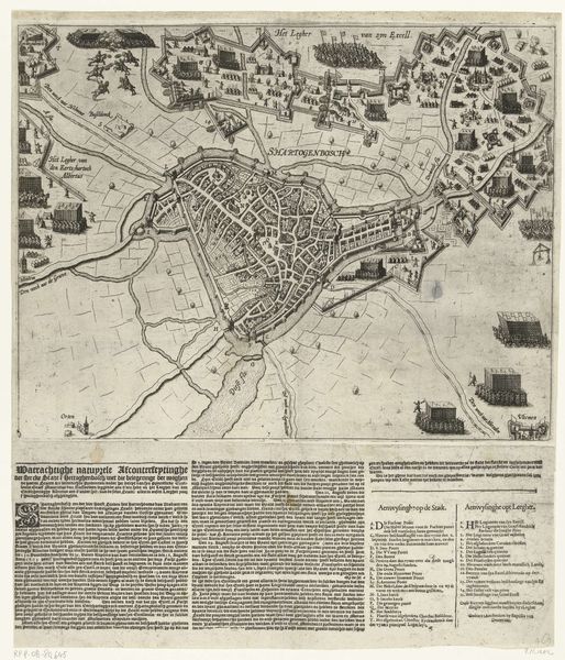
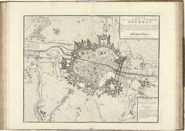
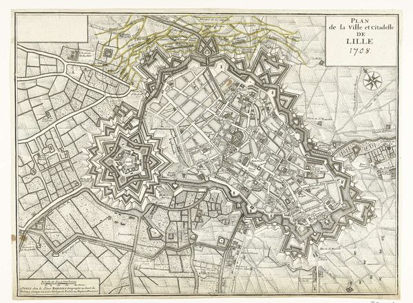
Curator: We are looking at "Beleg van Douai, 1710," a print currently housed at the Rijksmuseum, created anonymously. What strikes you first? Editor: The detail! It's a formal birds-eye view of Douai during a siege, meticulously rendered as if capturing a tense but gorgeous moment in a meticulously choreographed war ballet. I am immediately drawn to its precision but also sensing the intense energy held back, it is mesmerizing and terrifying at once. Curator: As an engraving from 1710, it's part of a larger printmaking tradition of visualizing conflict and power. This wasn't just art; it was information, propaganda, a carefully constructed narrative etched onto a copper plate and multiplied. Think about the engraver, translating what was, perhaps, once sketched by an officer into this highly formal image... Editor: And the materiality of it all! Copper, acid, ink… all manipulated to portray military dominance and urban planning. It's like a map, a political statement, and a commodity all rolled into one. You imagine workshops full of artisans producing these, fueled by patronage and the demand for representations of conquest. There is intense collaboration needed in all steps. Curator: Indeed. I keep wondering about the human element removed from this otherwise detailed visual. This depiction leaves very little space for a more intimate narrative. Yet I feel such sense of tension here... This rendering of Douai is a perfect example of how to convey emotional narrative without human characters. It invites speculation on the realities obscured by such orderly presentations of history. Editor: It's the difference between the story and the STORY. What does the siege *feel* like? This piece, while incredibly informative and, dare I say beautiful, it gives us the story that favors the powerful. So I guess it prompts us to look beyond and dig up alternative narratives that exist outside these controlled depictions. Curator: Absolutely. It's a reminder that even the most precise representations are constructs, laden with choices, omissions, and a very specific point of view, isn't it? Editor: Exactly. Thinking about this piece has reframed my views. It allows me to ponder on all material and emotional implications of rendering even simplest accounts of conflict.
Comments
No comments
Be the first to comment and join the conversation on the ultimate creative platform.
More like this