drawing, ink
#
drawing
#
baroque
#
ink
#
cityscape
#
history-painting
Dimensions: height 372 mm, width 503 mm
Copyright: Rijks Museum: Open Domain
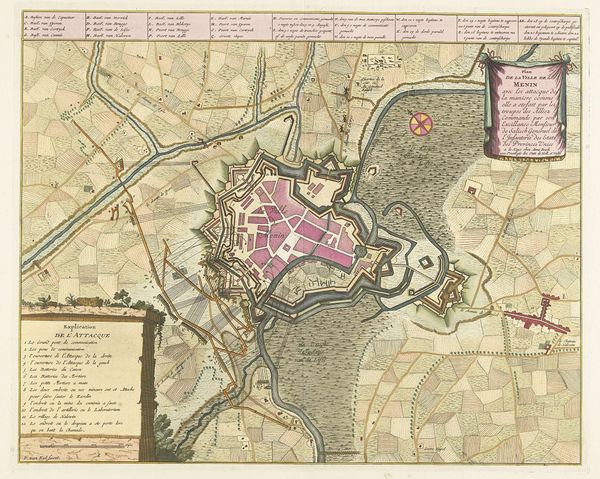
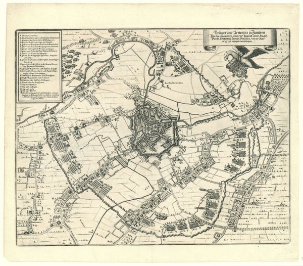
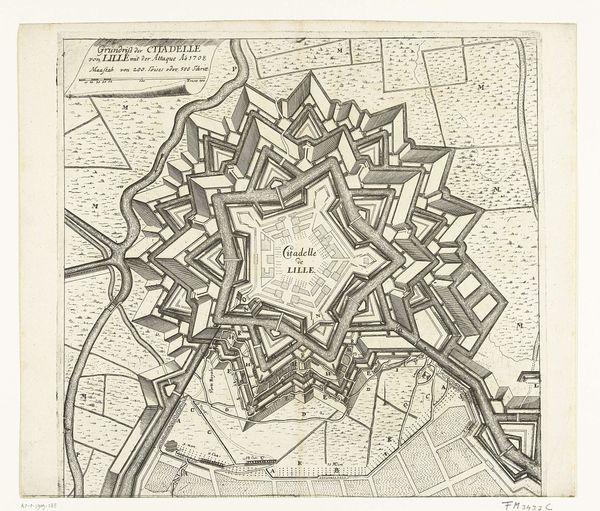
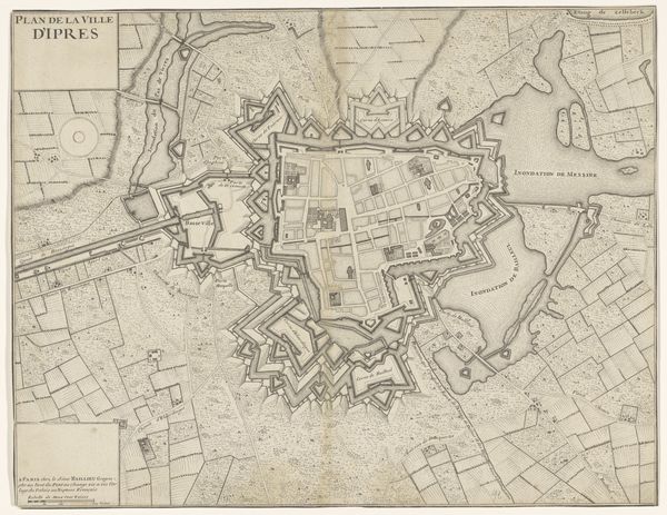
Curator: I'd like to draw your attention to this fascinating plan of Lille and its citadel, created in 1708 using ink. It depicts the city during the War of the Spanish Succession. Editor: My initial impression is one of intense control, an almost suffocating level of geometric precision. You feel the grip of military power in every line. Curator: Absolutely. The rigid lines speak volumes about the period’s obsession with order and defense. It's not just a map, it is a power play enacted on paper reflecting not only the city, but the deep social hierarchies of 18th century France and Europe. Editor: Look at how the fortifications – those star-shaped patterns – dominate the visual space, almost as symbolic mandalas protecting inner sanctums. The sheer repetition of those sharp angles really imprints on the subconscious. It shows a very clear visual language related to military and authority. Curator: Those fortifications, designed by Vauban, are the material expression of Baroque anxieties, reflecting power but also anxieties surrounding territorial control during intense political and religious upheaval. The historical backdrop is as critical to this piece as the lines on the paper. Editor: It makes you wonder about the people who lived within those walls and outside them. What did this visual language mean to the people living under siege? We are used to the language of mapmaking, but they read it daily to see where their own positions were in relation to this theater of conflict. Curator: Indeed, that interplay between grand strategy and individual experience exposes the paradoxes inherent in warfare and points at critical class division in European History. Editor: It strikes me that even seemingly technical images are rich in visual symbolism, revealing deep historical traces and resonating with emotional power over time. It is like the memory palace of a civilization being written through imagery. Curator: Agreed. By studying this map through those various lenses, we can understand the plan not merely as a factual representation, but as a commentary on war and its discontents, then and now. Editor: Thank you for guiding me on a rich visual-historical trip into 18th-century France through just a simple drawing.
Comments
No comments
Be the first to comment and join the conversation on the ultimate creative platform.
More like this