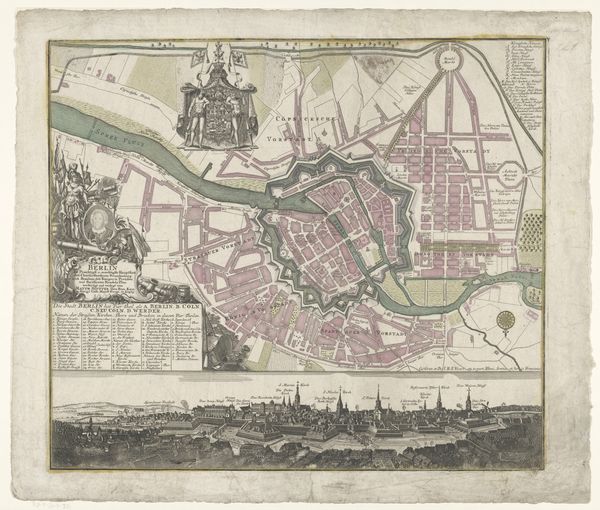
print, engraving
#
baroque
# print
#
cityscape
#
engraving
Dimensions: height 501 mm, width 587 mm
Copyright: Rijks Museum: Open Domain
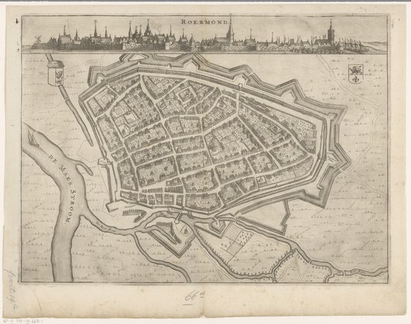
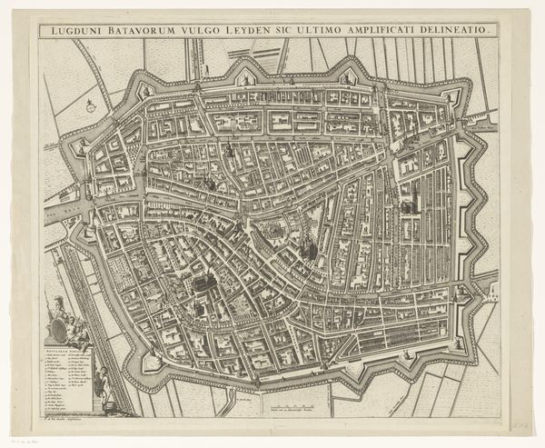
This is Matthaeus Seutter's map of Brussels, a detailed depiction rendered with ink and color. The most striking feature is the city's layout, encased within formidable fortifications. These walls, bastions, and moats are not merely physical defenses; they symbolize security, order, and power. Echoes of such fortifications resonate throughout history—from ancient city-states to medieval castles, each iteration reflecting humanity's enduring quest for protection. Consider the recurring motif of the wall. In antiquity, walls like those of Troy represented both refuge and confinement. Over time, as societies evolved, so did our understanding of such boundaries. Walls can protect, but also isolate, and generate anxiety, reflecting a collective subconscious tension between safety and freedom. As you gaze upon this map, contemplate how these symbols, seemingly static, ripple through time, perpetually re-emerging in our collective consciousness, shaping our cities and our souls.
Comments
No comments
Be the first to comment and join the conversation on the ultimate creative platform.
More like this