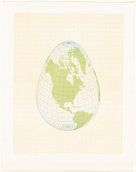
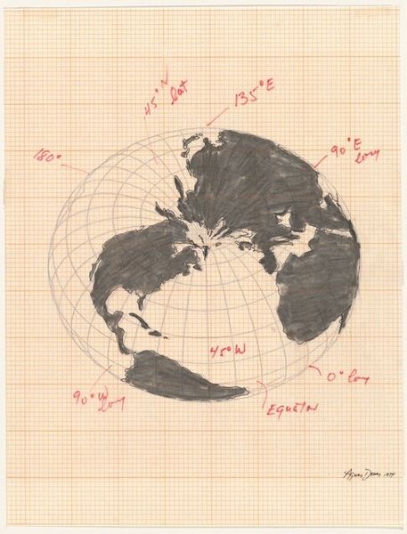
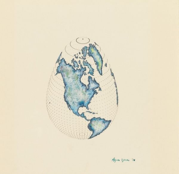
conceptual-art
landscape
etching
geometric
Dimensions: overall: 75.6 x 91.4 cm (29 3/4 x 36 in.)
Copyright: National Gallery of Art: CC0 1.0
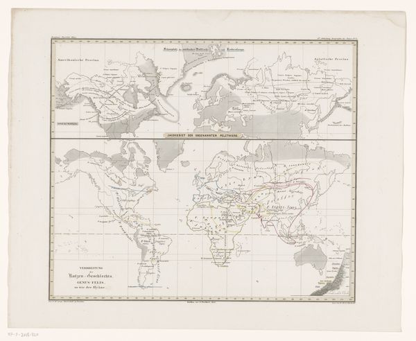
Curator: This is Agnes Denes’ “Map Projections: The Snail I," created in 1976. It’s a thought-provoking etching. What’s your first reaction to it? Editor: My first impression is one of delicate distortion. The continents, rendered in soft coral, curve into a Fibonacci-esque spiral. It feels like the world is being pulled, reshaped, but in a strangely organic way. Curator: Exactly. Denes' work often delves into the human relationship with systems of knowledge, how we impose order, sometimes arbitrarily, on the world. The snail form is about exponential growth, about where humanity is situated within that pattern. Editor: Right, and map-making itself is such a loaded political act. Projecting a three-dimensional globe onto a flat surface inherently involves choices – which regions to prioritize, what distortions to accept. The snail form challenges the perceived neutrality of these projections. How do societal power structures inform artistic expression, and who is being silenced here? Curator: Indeed, Denes challenges our perceived realities by reframing geographical representation within historical and social contexts. By choosing a snail's form, she references this growth, perhaps our economic expansion as well, highlighting the uneven distribution and ecological effects that such global models tend to marginalize, Editor: It makes me consider how seemingly objective systems, like cartography, are always entangled with ideology. There is a sort of flattening of our own human influence when rendering this spiral; one feels we must reconsider what global 'unity' can even look like through the framework she establishes. Curator: The muted tones give it an almost archival quality, inviting us to reconsider historical modes of representation with a sharp focus on those critical and unequal dynamics. Denes is posing critical questions that remain vital today, urging viewers to consider whose perspectives dominate the creation of such maps and the historical consequences of such models. Editor: A lot of what Denes did here, the very real concern that our systems of measurements create inherent biases that often uphold oppressive agendas. It really shows how we ought to re-evaluate all these old colonial models in our contemporary contexts. Curator: It serves as a powerful visual statement of our collective responsibility and a powerful metaphor that can drive action.
Comments
No comments
Be the first to comment and join the conversation on the ultimate creative platform.