print, engraving
#
baroque
# print
#
geometric
#
cityscape
#
engraving
Dimensions: height 243 mm, width 330 mm
Copyright: Rijks Museum: Open Domain
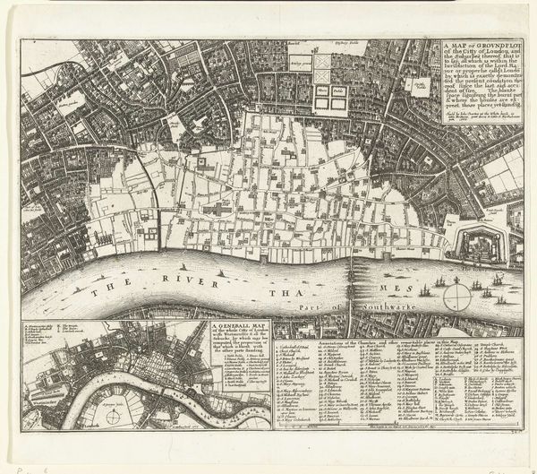
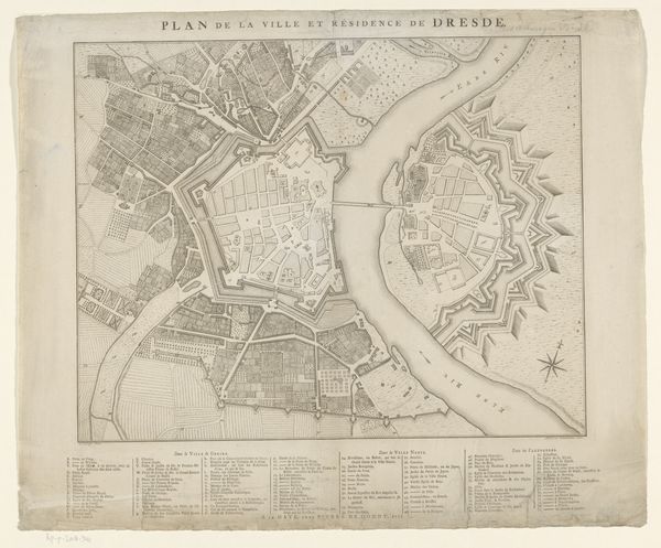
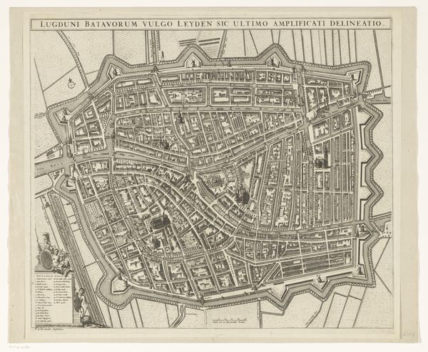
This is an anonymous map of London, made in 1726, offering us a detailed view of the city and its surroundings during the early 18th century. As we consider this map, it’s important to acknowledge the historical context of cartography. Maps weren't simply neutral representations; they were instruments of power and control. Created during a period of intense urbanization and colonial expansion, this map reflects the growing importance of London as a global hub of commerce and empire. It highlights the city's infrastructure, trade routes, and key landmarks, which served the interests of the ruling classes. Yet, the map also obscures the lives and experiences of the working-class residents who lived in poverty, often excluded from the official narratives of the time. While examining this map, we can recognize the narratives it tells and the ones it leaves out. It serves as a reminder of the complexities inherent in any representation of history and society.
Comments
No comments
Be the first to comment and join the conversation on the ultimate creative platform.
More like this