drawing, print, etching, paper, ink
#
drawing
#
dutch-golden-age
#
mechanical pen drawing
# print
#
pen illustration
#
pen sketch
#
etching
#
landscape
#
paper
#
personal sketchbook
#
linework heavy
#
ink
#
sketchwork
#
geometric
#
pen-ink sketch
#
pen work
#
sketchbook drawing
#
cityscape
#
storyboard and sketchbook work
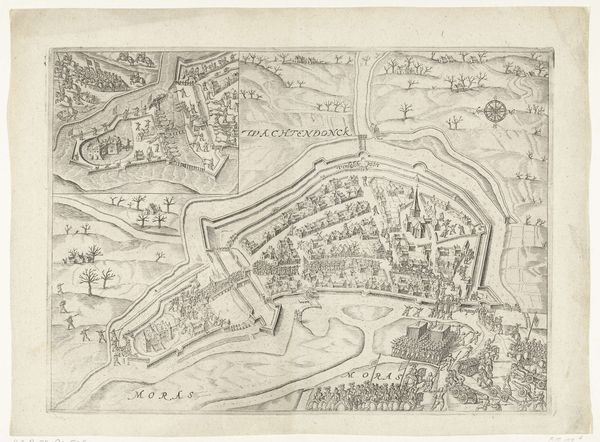
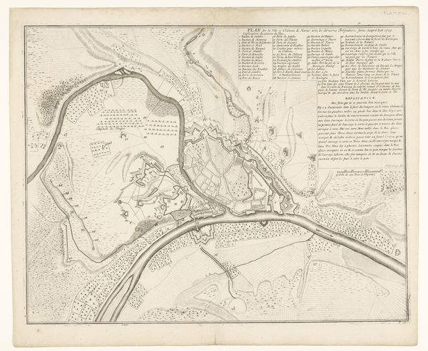
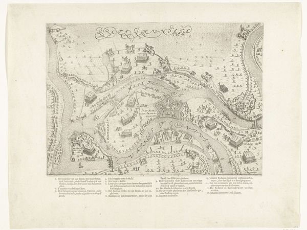
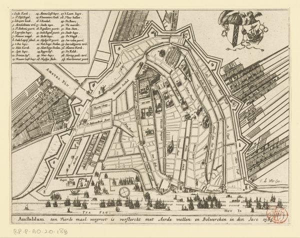
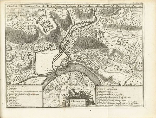
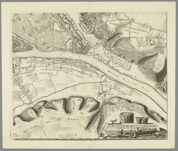
Dimensions: height 633 mm, width 910 mm
Copyright: Rijks Museum: Open Domain
Curator: So, here we have Willem Hondius’s "Beleg van Schenckenschans, 1635," a detailed etching, a dance of ink and paper depicting a cityscape under siege. Editor: It's captivatingly claustrophobic. All these precise lines hem you in, echoing the siege itself. You almost feel like you are one of those poor devils trapped within. Curator: Precisely. Hondius, working within the Dutch Golden Age aesthetic, marries artistic precision with functional documentation. The intricate lines aren't just aesthetic; they painstakingly map the fortifications, troop movements, and geographical layout. Look closely, and you will notice he’s etching a moment of intense social and political upheaval with such painstaking detail. Editor: It’s interesting to see the contrast between the highly formalized depiction of the fortresses, like geometric abstractions of power, versus the tiny, almost frantic lines representing the human cost. This kind of obsessive detail must have been immensely labor-intensive, engraving all of that information. I wonder who was using these prints—commanders? Everyday citizens hungry for news? Curator: Possibly both. Prints like these served various purposes: military strategy, civic pride, and public consumption. Hondius ingeniously caters to all those needs, elevating printmaking into a craft of communication. In thinking of those fortifications, one wonders what was actually made or produced there other than instruments of war. It's strange to consider fortifications as products themselves; products of fear. Editor: And fear drives the economy of war, which in turn consumes material resources, human labor. It is really disturbing if you look at it as layers of paper, ink, and sweat mirroring the actual walls of stone and blood defending against further taking and consumption. It makes me ponder how "accurate" art like this truly is. Curator: That tension between representation and the human experience lies at the core of so much landscape art from this period. The print captures this event, but we are invited to read all these possible other meanings that go far beyond that particular place and time. Editor: Looking at this "Beleg van Schenckenschans" laid out, like a grim board game frozen in time, it makes me reflect on how material representations shape our understanding of history. And what they often purposefully obscure. Curator: A somber cartography then, a battle waged on paper. Editor: Exactly, and perhaps all battlefields, past and future, are partially, inevitably made of paper, too.
Comments
No comments
Be the first to comment and join the conversation on the ultimate creative platform.
More like this