#
mechanical pen drawing
#
pen sketch
#
old engraving style
#
sketch book
#
personal sketchbook
#
sketchwork
#
pen-ink sketch
#
thin linework
#
pen work
#
storyboard and sketchbook work
Dimensions: height 234 mm, width 317 mm
Copyright: Rijks Museum: Open Domain
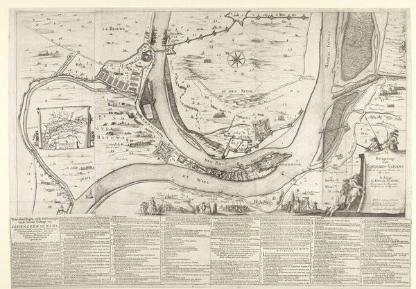
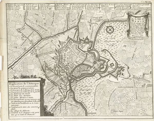
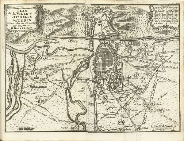
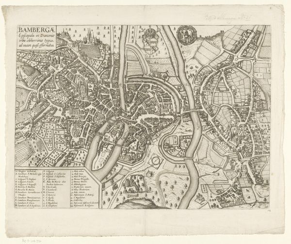
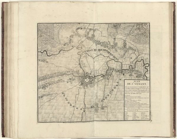
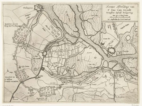
Curator: So, we're looking at a fascinating map here, titled "Kaart van het beleg van Rijnberg, 1633." It's from 1633, anonymous, done as a mechanical pen drawing. Editor: It’s striking how detailed it is. I can see the town laid out within fortifications, almost like a board game ready to be played, but on a much larger scale and much deadlier terms. What am I supposed to be seeing here? Curator: What you’re seeing is more than just a map; it's a strategic piece of political imagery. Maps like these weren't just about geographical accuracy, but about power. Who commissioned it, do you think, and what purpose did it serve beyond mere record-keeping? Editor: Well, the text indicates it documents the siege of Rhynberck. I guess, a military leader involved? To commemorate a victory or plan future strategy? Curator: Precisely. These maps visually documented military victories, demonstrating territorial control and asserting dominance. They were circulated among elites and served as propaganda, reinforcing the power and legitimacy of the ruling class. The map itself *performed* power. It wasn't neutral. Editor: So, this isn’t just information; it’s a carefully constructed message. I can see how even the style—the meticulous linework, the almost clinical detachment—contributes to a sense of control and authority. Did these maps influence public perception of military events? Curator: Absolutely. Consider the intended audience. How would seeing this "objective" representation shape their understanding of the conflict, particularly regarding the victors’ strength and the defeated's vulnerability? Maps offer a kind of total knowledge, positioning the viewer as all-seeing. Editor: That makes the visual language really significant. I see the pen strokes depicting landscapes, water flows… I’d previously disregarded those marks as part of map conventions. It makes me consider the layers that make up this document as both tool and artwork. Curator: Exactly! So, the next time you encounter a historical map, remember to look beyond the lines and symbols. Consider the power dynamics, the social context, and the messages embedded within. Editor: This has completely changed how I’ll look at maps from now on. Thank you!
Comments
No comments
Be the first to comment and join the conversation on the ultimate creative platform.
More like this